

schwauna-attnang-ottnang
A cycling route starting in Schwanenstadt, Upper Austria, Austria.
Overview
About this route
pampa
- -:--
- Duration
- 29.7 km
- Distance
- 0 m
- Ascent
- 0 m
- Descent
- ---
- Avg. speed
- ---
- Max. altitude

Route quality
Waytypes & surfaces along the route
Waytypes
Busy road
19.4 km
(65 %)
Road
8.2 km
(28 %)
Surfaces
Paved
19.5 km
(66 %)
Unpaved
0.1 km
(<1 %)
Asphalt
19.5 km
(66 %)
Ground
0.1 km
(<1 %)
Undefined
10.1 km
(34 %)
Continue with Bikemap
Use, edit, or download this cycling route
You would like to ride schwauna-attnang-ottnang or customize it for your own trip? Here is what you can do with this Bikemap route:
Free features
- Save this route as favorite or in collections
- Copy & plan your own version of this route
- Sync your route with Garmin or Wahoo
Premium features
Free trial for 3 days, or one-time payment. More about Bikemap Premium.
- Navigate this route on iOS & Android
- Export a GPX / KML file of this route
- Create your custom printout (try it for free)
- Download this route for offline navigation
Discover more Premium features.
Get Bikemap PremiumFrom our community
Other popular routes starting in Schwanenstadt
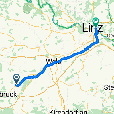 Schwanenstadt nach Linz
- Distance
- 63.9 km
- Ascent
- 128 m
- Descent
- 315 m
- Location
- Schwanenstadt, Upper Austria, Austria
 Wartenburg
- Distance
- 15.4 km
- Ascent
- 113 m
- Descent
- 50 m
- Location
- Schwanenstadt, Upper Austria, Austria
 3 SEEN Runde von Schwanenstadt
- Distance
- 126.8 km
- Ascent
- 967 m
- Descent
- 967 m
- Location
- Schwanenstadt, Upper Austria, Austria
 Schwanenstadt - Traun Radweg - Traunsee - Traun Radweg - Bad Ischl
- Distance
- 56.8 km
- Ascent
- 403 m
- Descent
- 391 m
- Location
- Schwanenstadt, Upper Austria, Austria
 180806-Schwanenstadt-St.Florian-Enns
- Distance
- 73 km
- Ascent
- 176 m
- Descent
- 309 m
- Location
- Schwanenstadt, Upper Austria, Austria
 schwauna-attnang-ottnang
- Distance
- 29.7 km
- Ascent
- 0 m
- Descent
- 0 m
- Location
- Schwanenstadt, Upper Austria, Austria
 Pinsdorf Attersee
- Distance
- 53.5 km
- Ascent
- 262 m
- Descent
- 264 m
- Location
- Schwanenstadt, Upper Austria, Austria
 Staig, Schlatt nach Staig, Schlatt
- Distance
- 15 km
- Ascent
- 63 m
- Descent
- 74 m
- Location
- Schwanenstadt, Upper Austria, Austria
Open it in the app