

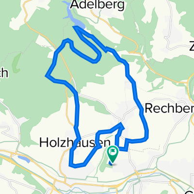
Rund um die 3 Kaiserberge
A cycling route starting in Uhingen, Baden-Wurttemberg, Germany.
Overview
About this route
Nice evening ride with some climbs!
- -:--
- Duration
- 65.4 km
- Distance
- 0 m
- Ascent
- 0 m
- Descent
- ---
- Avg. speed
- ---
- Max. altitude
Route quality
Waytypes & surfaces along the route
Waytypes
Road
26.1 km
(40 %)
Quiet road
11.8 km
(18 %)
Surfaces
Paved
57.5 km
(88 %)
Asphalt
56.9 km
(87 %)
Paved (undefined)
0.7 km
(1 %)
Undefined
7.8 km
(12 %)
Continue with Bikemap
Use, edit, or download this cycling route
You would like to ride Rund um die 3 Kaiserberge or customize it for your own trip? Here is what you can do with this Bikemap route:
Free features
- Save this route as favorite or in collections
- Copy & plan your own version of this route
- Sync your route with Garmin or Wahoo
Premium features
Free trial for 3 days, or one-time payment. More about Bikemap Premium.
- Navigate this route on iOS & Android
- Export a GPX / KML file of this route
- Create your custom printout (try it for free)
- Download this route for offline navigation
Discover more Premium features.
Get Bikemap PremiumFrom our community
Other popular routes starting in Uhingen
 Feierabendrunde Uhingen
- Distance
- 28 km
- Ascent
- 444 m
- Descent
- 449 m
- Location
- Uhingen, Baden-Wurttemberg, Germany
 19,3km, Faurndau - Herrenbachstausee - Holzhausen - Faurndau
- Distance
- 19.3 km
- Ascent
- 306 m
- Descent
- 306 m
- Location
- Uhingen, Baden-Wurttemberg, Germany
 Rund um die 3 Kaiserberge
- Distance
- 65.4 km
- Ascent
- 0 m
- Descent
- 0 m
- Location
- Uhingen, Baden-Wurttemberg, Germany
 Rundweg: Schlössertour
- Distance
- 13.4 km
- Ascent
- 169 m
- Descent
- 169 m
- Location
- Uhingen, Baden-Wurttemberg, Germany
 Goethestraße 12, Uhingen nach Eugenstraße 23, Schorndorf
- Distance
- 19.5 km
- Ascent
- 352 m
- Descent
- 397 m
- Location
- Uhingen, Baden-Wurttemberg, Germany
 Nassachtal-Digelsberg-Kaisersträssle-Oberkirneck-Wangen-Nassachtal
- Distance
- 43.4 km
- Ascent
- 385 m
- Descent
- 385 m
- Location
- Uhingen, Baden-Wurttemberg, Germany
 Oestliche Schurwaldroute
- Distance
- 48.9 km
- Ascent
- 396 m
- Descent
- 397 m
- Location
- Uhingen, Baden-Wurttemberg, Germany
 Stauferlandrunde
- Distance
- 41.3 km
- Ascent
- 571 m
- Descent
- 559 m
- Location
- Uhingen, Baden-Wurttemberg, Germany
Open it in the app