

Runde Schildgen - Witzhelden
A cycling route starting in Odenthal, North Rhine-Westphalia, Germany.
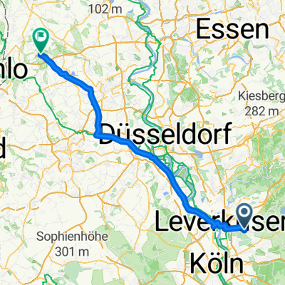
Overview
About this route
Varied route, partly following beautiful and little-traveled side roads. A very short gravel section, 100 m of pushing for racing bikes is required.
- -:--
- Duration
- 42.1 km
- Distance
- 375 m
- Ascent
- 351 m
- Descent
- ---
- Avg. speed
- 237 m
- Max. altitude

Route quality
Waytypes & surfaces along the route
Waytypes
Quiet road
15.2 km
(36 %)
Path
5.9 km
(14 %)
Surfaces
Paved
29.5 km
(70 %)
Unpaved
0.8 km
(2 %)
Asphalt
29.5 km
(70 %)
Gravel
0.4 km
(1 %)
Continue with Bikemap
Use, edit, or download this cycling route
You would like to ride Runde Schildgen - Witzhelden or customize it for your own trip? Here is what you can do with this Bikemap route:
Free features
- Save this route as favorite or in collections
- Copy & plan your own version of this route
- Sync your route with Garmin or Wahoo
Premium features
Free trial for 3 days, or one-time payment. More about Bikemap Premium.
- Navigate this route on iOS & Android
- Export a GPX / KML file of this route
- Create your custom printout (try it for free)
- Download this route for offline navigation
Discover more Premium features.
Get Bikemap PremiumFrom our community
Other popular routes starting in Odenthal
 Odenthal - Wachtendonk
- Distance
- 80.2 km
- Ascent
- 83 m
- Descent
- 128 m
- Location
- Odenthal, North Rhine-Westphalia, Germany
 Altenberg MTB rookie
- Distance
- 10.1 km
- Ascent
- 217 m
- Descent
- 209 m
- Location
- Odenthal, North Rhine-Westphalia, Germany
 Neschen-Große Dhünntalsperren-Dabringhausen-Altenberg-Neschen
- Distance
- 31.2 km
- Ascent
- 435 m
- Descent
- 435 m
- Location
- Odenthal, North Rhine-Westphalia, Germany
 Sengbachtalsperre und Wuppertour
- Distance
- 39.1 km
- Ascent
- 531 m
- Descent
- 531 m
- Location
- Odenthal, North Rhine-Westphalia, Germany
 Leverkusener Radralley Tour_1
- Distance
- 42.9 km
- Ascent
- 399 m
- Descent
- 397 m
- Location
- Odenthal, North Rhine-Westphalia, Germany
 Balkantrasse n. Lennep u. zurück
- Distance
- 49.7 km
- Ascent
- 655 m
- Descent
- 656 m
- Location
- Odenthal, North Rhine-Westphalia, Germany
 MTB am "Wildpark"
- Distance
- 7.5 km
- Ascent
- 191 m
- Descent
- 191 m
- Location
- Odenthal, North Rhine-Westphalia, Germany
 Odenthaler Rundfahrt
- Distance
- 36.3 km
- Ascent
- 526 m
- Descent
- 531 m
- Location
- Odenthal, North Rhine-Westphalia, Germany
Open it in the app