

Zemplén karika
A cycling route starting in Tolcsva, Borsod-Abauj Zemplen county, Hungary.
Overview
About this route
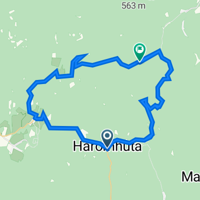
From Tolcsvá to Tolcsvá :)
- -:--
- Duration
- 63.6 km
- Distance
- 516 m
- Ascent
- 513 m
- Descent
- ---
- Avg. speed
- ---
- Max. altitude

Route quality
Waytypes & surfaces along the route
Waytypes
Quiet road
4.5 km
(7 %)
Access road
1.9 km
(3 %)
Surfaces
Paved
9.5 km
(15 %)
Asphalt
9.5 km
(15 %)
Undefined
54.1 km
(85 %)
Continue with Bikemap
Use, edit, or download this cycling route
You would like to ride Zemplén karika or customize it for your own trip? Here is what you can do with this Bikemap route:
Free features
- Save this route as favorite or in collections
- Copy & plan your own version of this route
- Sync your route with Garmin or Wahoo
Premium features
Free trial for 3 days, or one-time payment. More about Bikemap Premium.
- Navigate this route on iOS & Android
- Export a GPX / KML file of this route
- Create your custom printout (try it for free)
- Download this route for offline navigation
Discover more Premium features.
Get Bikemap PremiumFrom our community
Other popular routes starting in Tolcsva
 Zemplén karika
- Distance
- 63.6 km
- Ascent
- 516 m
- Descent
- 513 m
- Location
- Tolcsva, Borsod-Abauj Zemplen county, Hungary
 Kékednek
- Distance
- 125 km
- Ascent
- 701 m
- Descent
- 701 m
- Location
- Tolcsva, Borsod-Abauj Zemplen county, Hungary
 TOLCSVA Kör
- Distance
- 61.2 km
- Ascent
- 863 m
- Descent
- 860 m
- Location
- Tolcsva, Borsod-Abauj Zemplen county, Hungary
 Zempléni túra 2 nap
- Distance
- 85.2 km
- Ascent
- 547 m
- Descent
- 545 m
- Location
- Tolcsva, Borsod-Abauj Zemplen county, Hungary
 Zemplén 3. nap
- Distance
- 61.5 km
- Ascent
- 540 m
- Descent
- 540 m
- Location
- Tolcsva, Borsod-Abauj Zemplen county, Hungary
 Petőfi út 26, Háromhuta to Petőfi út 18, Háromhuta
- Distance
- 53.7 km
- Ascent
- 1,692 m
- Descent
- 1,715 m
- Location
- Tolcsva, Borsod-Abauj Zemplen county, Hungary
 óhuta-kőkapu-regéc-óhuta
- Distance
- 49.9 km
- Ascent
- 1,096 m
- Descent
- 1,085 m
- Location
- Tolcsva, Borsod-Abauj Zemplen county, Hungary
 É-M.o/3
- Distance
- 96.7 km
- Ascent
- 107 m
- Descent
- 217 m
- Location
- Tolcsva, Borsod-Abauj Zemplen county, Hungary
Open it in the app