

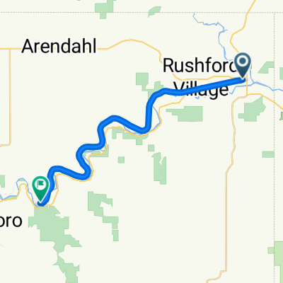
Our Root River Bike Trail Ride (Rushford to Houston and back. Then, Rushford to Lanesboro and back.)
A cycling route starting in Rushford, Minnesota, United States.
Overview
About this route
For our 20th Wedding Anniversary, we rode 61.8 miles on the Root River Trail.
- -:--
- Duration
- 99.8 km
- Distance
- 280 m
- Ascent
- 286 m
- Descent
- ---
- Avg. speed
- ---
- Max. altitude

Route quality
Waytypes & surfaces along the route
Waytypes
Cycleway
97.4 km
(98 %)
Track
2.3 km
(2 %)
Surfaces
Paved
97.4 km
(98 %)
Unpaved
2.3 km
(2 %)
Paved (undefined)
97.4 km
(98 %)
Ground
2.3 km
(2 %)
Undefined
0 km
(<1 %)
Continue with Bikemap
Use, edit, or download this cycling route
You would like to ride Our Root River Bike Trail Ride (Rushford to Houston and back. Then, Rushford to Lanesboro and back.) or customize it for your own trip? Here is what you can do with this Bikemap route:
Free features
- Save this route as favorite or in collections
- Copy & plan your own version of this route
- Split it into stages to create a multi-day tour
- Sync your route with Garmin or Wahoo
Premium features
Free trial for 3 days, or one-time payment. More about Bikemap Premium.
- Navigate this route on iOS & Android
- Export a GPX / KML file of this route
- Create your custom printout (try it for free)
- Download this route for offline navigation
Discover more Premium features.
Get Bikemap PremiumFrom our community
Other popular routes starting in Rushford
 50-Rush-Hust-Brat-12-Lane-W
- Distance
- 79.4 km
- Ascent
- 459 m
- Descent
- 436 m
- Location
- Rushford, Minnesota, United States
 Our Root River Bike Trail Ride (Rushford to Houston and back. Then, Rushford to Lanesboro and back.)
- Distance
- 99.8 km
- Ascent
- 280 m
- Descent
- 286 m
- Location
- Rushford, Minnesota, United States
 112–138 N Mill St, Rushford to 100 N Mill St, Rushford
- Distance
- 62.9 km
- Ascent
- 218 m
- Descent
- 218 m
- Location
- Rushford, Minnesota, United States
 Houston to a few miles west of Rushford (Root River Trail)
- Distance
- 23.7 km
- Ascent
- 219 m
- Descent
- 202 m
- Location
- Rushford, Minnesota, United States
 45-Rush-Hous-Rush
- Distance
- 70.4 km
- Ascent
- 376 m
- Descent
- 376 m
- Location
- Rushford, Minnesota, United States
 lanesboro
- Distance
- 30.8 km
- Ascent
- 1,051 m
- Descent
- 1,014 m
- Location
- Rushford, Minnesota, United States
 Root River State Trail, Lanesboro to Coffee Street West 103, Lanesboro
- Distance
- 34.6 km
- Ascent
- 237 m
- Descent
- 213 m
- Location
- Rushford, Minnesota, United States
 Route to Alley Drive
- Distance
- 22.2 km
- Ascent
- 92 m
- Descent
- 40 m
- Location
- Rushford, Minnesota, United States
Open it in the app