

Radom - Taczów - Nieczatów - Milejowice - Bielicha
A cycling route starting in Radom, Masovian Voivodeship, Poland.
Overview
About this route
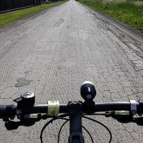
Easy, recreational route near Radom, 90% asphalt, minimal elevation changes.
- -:--
- Duration
- 35.1 km
- Distance
- 105 m
- Ascent
- 108 m
- Descent
- ---
- Avg. speed
- ---
- Max. altitude

Route quality
Waytypes & surfaces along the route
Waytypes
Road
12.3 km
(35 %)
Quiet road
8.1 km
(23 %)
Surfaces
Paved
24.2 km
(69 %)
Unpaved
1.1 km
(3 %)
Asphalt
24.2 km
(69 %)
Unpaved (undefined)
0.7 km
(2 %)
Continue with Bikemap
Use, edit, or download this cycling route
You would like to ride Radom - Taczów - Nieczatów - Milejowice - Bielicha or customize it for your own trip? Here is what you can do with this Bikemap route:
Free features
- Save this route as favorite or in collections
- Copy & plan your own version of this route
- Sync your route with Garmin or Wahoo
Premium features
Free trial for 3 days, or one-time payment. More about Bikemap Premium.
- Navigate this route on iOS & Android
- Export a GPX / KML file of this route
- Create your custom printout (try it for free)
- Download this route for offline navigation
Discover more Premium features.
Get Bikemap PremiumFrom our community
Other popular routes starting in Radom
 Radom-Klwatka
- Distance
- 17.2 km
- Ascent
- 82 m
- Descent
- 82 m
- Location
- Radom, Masovian Voivodeship, Poland
 Do Ilzy
- Distance
- 81.4 km
- Ascent
- 0 m
- Descent
- 0 m
- Location
- Radom, Masovian Voivodeship, Poland
 Królewskie Żródła
- Distance
- 76.6 km
- Ascent
- 156 m
- Descent
- 155 m
- Location
- Radom, Masovian Voivodeship, Poland
 leśna trasa
- Distance
- 61.2 km
- Ascent
- 157 m
- Descent
- 154 m
- Location
- Radom, Masovian Voivodeship, Poland
 Radom i Puszcza Kozienicka
- Distance
- 60 km
- Ascent
- 0 m
- Descent
- 0 m
- Location
- Radom, Masovian Voivodeship, Poland
 Radom 50km
- Distance
- 50.3 km
- Ascent
- 276 m
- Descent
- 276 m
- Location
- Radom, Masovian Voivodeship, Poland
 Radom - Ciepielów(Stary Kawęczyn) i z powrotem
- Distance
- 100.4 km
- Ascent
- 137 m
- Descent
- 140 m
- Location
- Radom, Masovian Voivodeship, Poland
 znakowanie
- Distance
- 13 km
- Ascent
- 52 m
- Descent
- 65 m
- Location
- Radom, Masovian Voivodeship, Poland
Open it in the app