

Nord de Retz
A cycling route starting in Villers-Cotterêts, Hauts-de-France, France.
Overview
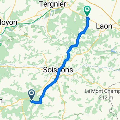
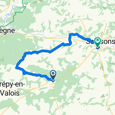
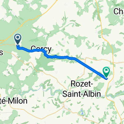
About this route
Walk to do soon; lunch in Longpont!
- -:--
- Duration
- 37.7 km
- Distance
- 336 m
- Ascent
- 336 m
- Descent
- ---
- Avg. speed
- ---
- Max. altitude

Route quality
Waytypes & surfaces along the route
Waytypes
Road
22.6 km
(60 %)
Quiet road
2.6 km
(7 %)
Undefined
12.4 km
(33 %)
Continue with Bikemap
Use, edit, or download this cycling route
You would like to ride Nord de Retz or customize it for your own trip? Here is what you can do with this Bikemap route:
Free features
- Save this route as favorite or in collections
- Copy & plan your own version of this route
- Sync your route with Garmin or Wahoo
Premium features
Free trial for 3 days, or one-time payment. More about Bikemap Premium.
- Navigate this route on iOS & Android
- Export a GPX / KML file of this route
- Create your custom printout (try it for free)
- Download this route for offline navigation
Discover more Premium features.
Get Bikemap PremiumFrom our community
Other popular routes starting in Villers-Cotterêts
 Chemin de Puisseux, Fleury à Rue Paul Dangenne, Crépy
- Distance
- 59.2 km
- Ascent
- 527 m
- Descent
- 567 m
- Location
- Villers-Cotterêts, Hauts-de-France, France
 VillersCottêrets-Joigny TDF 2007
- Distance
- 196 km
- Ascent
- 895 m
- Descent
- 946 m
- Location
- Villers-Cotterêts, Hauts-de-France, France
 Montgobert - Saint-Pierre-Aigle - Longpont
- Distance
- 24.9 km
- Ascent
- 246 m
- Descent
- 246 m
- Location
- Villers-Cotterêts, Hauts-de-France, France
 etape3
- Distance
- 94.6 km
- Ascent
- 326 m
- Descent
- 382 m
- Location
- Villers-Cotterêts, Hauts-de-France, France
 hjk gfhgf f hgf
- Distance
- 35.1 km
- Ascent
- 416 m
- Descent
- 450 m
- Location
- Villers-Cotterêts, Hauts-de-France, France
 Nord de Retz
- Distance
- 37.7 km
- Ascent
- 336 m
- Descent
- 336 m
- Location
- Villers-Cotterêts, Hauts-de-France, France
 Forêt de Retz-Valois-Soissons
- Distance
- 57.6 km
- Ascent
- 400 m
- Descent
- 484 m
- Location
- Villers-Cotterêts, Hauts-de-France, France
 Rue de la Plaine, Fleury à D 22, Oulchy-la-Ville
- Distance
- 17.2 km
- Ascent
- 82 m
- Descent
- 89 m
- Location
- Villers-Cotterêts, Hauts-de-France, France
Open it in the app