

Testrunde
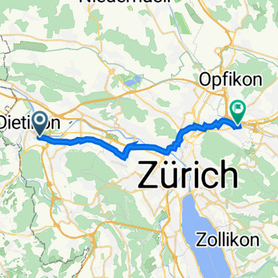
A cycling route starting in Dietikon / Guggenbühl, Canton of Zurich, Switzerland.
Overview
About this route
Test
- -:--
- Duration
- 0.6 km
- Distance
- 0 m
- Ascent
- 4 m
- Descent
- ---
- Avg. speed
- ---
- Max. altitude
Route quality
Waytypes & surfaces along the route
Waytypes
Track
0.6 km
(100 %)
Surfaces
Paved
0.6 km
(100 %)
Asphalt
0.6 km
(100 %)
Route highlights
Points of interest along the route
Point of interest after 0 km
Point of interest after 0.1 km
Continue with Bikemap
Use, edit, or download this cycling route
You would like to ride Testrunde or customize it for your own trip? Here is what you can do with this Bikemap route:
Free features
- Save this route as favorite or in collections
- Copy & plan your own version of this route
- Sync your route with Garmin or Wahoo
Premium features
Free trial for 3 days, or one-time payment. More about Bikemap Premium.
- Navigate this route on iOS & Android
- Export a GPX / KML file of this route
- Create your custom printout (try it for free)
- Download this route for offline navigation
Discover more Premium features.
Get Bikemap PremiumFrom our community
Other popular routes starting in Dietikon / Guggenbühl
 CH-Dietikon - Türlersee 64km 1000hm
- Distance
- 62.7 km
- Ascent
- 667 m
- Descent
- 668 m
- Location
- Dietikon / Guggenbühl, Canton of Zurich, Switzerland
 De Schöneggstrasse 37, Dietikon a Schürrainweg 4, Schlieren
- Distance
- 3.5 km
- Ascent
- 12 m
- Descent
- 0 m
- Location
- Dietikon / Guggenbühl, Canton of Zurich, Switzerland
 Niederholzstrasse 5, Weiningen nach Fahrweid, Limmatbrücke, Weiningen
- Distance
- 80.1 km
- Ascent
- 504 m
- Descent
- 502 m
- Location
- Dietikon / Guggenbühl, Canton of Zurich, Switzerland
 Zürcherstrasse 134, Dietikon nach Winterthurerstrasse 698, Zürich
- Distance
- 16.2 km
- Ascent
- 910 m
- Descent
- 870 m
- Location
- Dietikon / Guggenbühl, Canton of Zurich, Switzerland
 Zürcherstrasse 136, Dietikon nach Winterthurerstrasse 694, Zürich
- Distance
- 16 km
- Ascent
- 528 m
- Descent
- 491 m
- Location
- Dietikon / Guggenbühl, Canton of Zurich, Switzerland
 Buchsackerstrasse 5, Dietikon to Heinrichstrasse 221, Zürich
- Distance
- 9.8 km
- Ascent
- 28 m
- Descent
- 6 m
- Location
- Dietikon / Guggenbühl, Canton of Zurich, Switzerland
 Testrunde
- Distance
- 0.6 km
- Ascent
- 0 m
- Descent
- 4 m
- Location
- Dietikon / Guggenbühl, Canton of Zurich, Switzerland
 Restful route in Dietikon
- Distance
- 3.4 km
- Ascent
- 3 m
- Descent
- 3 m
- Location
- Dietikon / Guggenbühl, Canton of Zurich, Switzerland
Open it in the app