

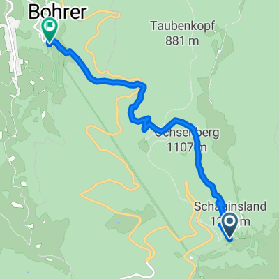
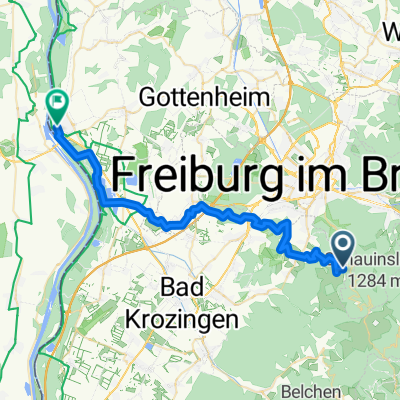
BUND Schauitag
A cycling route starting in Horben, Baden-Wurttemberg, Germany.
Overview
About this route
RIG-Freiburg Tourenangebot der Breitensportgruppe für den Schauinsland-Tag am 7.7.2013
Start ca. 9:00 Kaffeepause auf dem Schauinsland ca 10:15 Mittagspause in Neuenweg ca 13:00 (oder im Haldenhof) Kaffeepause in Laufen im Staudengarten der Gräfin von Zeppelin Heimfahrt bis zur Gaskugel ca. 1,5 Std- -:--
- Duration
- 87.6 km
- Distance
- 1,375 m
- Ascent
- 1,578 m
- Descent
- ---
- Avg. speed
- ---
- Max. altitude
Route quality
Waytypes & surfaces along the route
Waytypes
Busy road
61 km
(70 %)
Quiet road
8.4 km
(10 %)
Surfaces
Paved
76.6 km
(87 %)
Unpaved
1.6 km
(2 %)
Asphalt
75.6 km
(86 %)
Gravel
0.9 km
(1 %)
Continue with Bikemap
Use, edit, or download this cycling route
You would like to ride BUND Schauitag or customize it for your own trip? Here is what you can do with this Bikemap route:
Free features
- Save this route as favorite or in collections
- Copy & plan your own version of this route
- Split it into stages to create a multi-day tour
- Sync your route with Garmin or Wahoo
Premium features
Free trial for 3 days, or one-time payment. More about Bikemap Premium.
- Navigate this route on iOS & Android
- Export a GPX / KML file of this route
- Create your custom printout (try it for free)
- Download this route for offline navigation
Discover more Premium features.
Get Bikemap PremiumFrom our community
Other popular routes starting in Horben
 Schauinsland- Downhill- I
- Distance
- 5.4 km
- Ascent
- 87 m
- Descent
- 887 m
- Location
- Horben, Baden-Wurttemberg, Germany
 Schauinsland - Trail
- Distance
- 16.4 km
- Ascent
- 139 m
- Descent
- 1,119 m
- Location
- Horben, Baden-Wurttemberg, Germany
 Opfingen-Schauinsland-Canadian-Trail
- Distance
- 55.9 km
- Ascent
- 1,127 m
- Descent
- 1,129 m
- Location
- Horben, Baden-Wurttemberg, Germany
 Hansmartihof zum Belchen
- Distance
- 32.6 km
- Ascent
- 1,180 m
- Descent
- 413 m
- Location
- Horben, Baden-Wurttemberg, Germany
 13 ZW4 Wiedener Eck
- Distance
- 15.8 km
- Ascent
- 320 m
- Descent
- 480 m
- Location
- Horben, Baden-Wurttemberg, Germany
 Feldbergtour 5.6.15
- Distance
- 49.1 km
- Ascent
- 1,217 m
- Descent
- 1,203 m
- Location
- Horben, Baden-Wurttemberg, Germany
 38 Horben - Tiengen - Breisach
- Distance
- 37.9 km
- Ascent
- 749 m
- Descent
- 990 m
- Location
- Horben, Baden-Wurttemberg, Germany
 13 Schauinsland - Eduardshöhe - Horben
- Distance
- 12.4 km
- Ascent
- 150 m
- Descent
- 874 m
- Location
- Horben, Baden-Wurttemberg, Germany
Open it in the app