
Tour de Clair
A cycling route starting in Bicske, Fejér, Hungary.
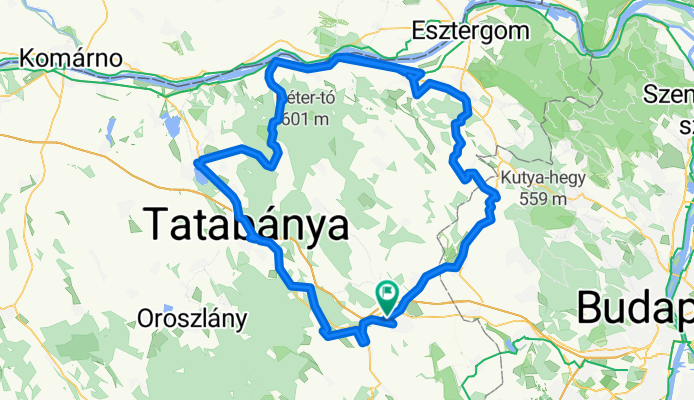
Overview
About this route
Hosszú és néhol nehéz de győnyőrű tájú kör. Időnként rossz az út minősége. Viszont a Dunaparton csodálotos mint az út, mint a táj.
Ajánlom mindenkinek.- -:--
- Duration
- 153.1 km
- Distance
- 651 m
- Ascent
- 653 m
- Descent
- ---
- Avg. speed
- ---
- Max. altitude

Route quality
Waytypes & surfaces along the route
Waytypes
Busy road
97.2 km
(63 %)
Quiet road
26.5 km
(17 %)
Surfaces
Paved
80.8 km
(53 %)
Unpaved
7.6 km
(5 %)
Asphalt
76.3 km
(50 %)
Unpaved (undefined)
6.3 km
(4 %)
Continue with Bikemap
Use, edit, or download this cycling route
You would like to ride Tour de Clair or customize it for your own trip? Here is what you can do with this Bikemap route:
Free features
- Save this route as favorite or in collections
- Copy & plan your own version of this route
- Split it into stages to create a multi-day tour
- Sync your route with Garmin or Wahoo
Premium features
Free trial for 3 days, or one-time payment. More about Bikemap Premium.
- Navigate this route on iOS & Android
- Export a GPX / KML file of this route
- Create your custom printout (try it for free)
- Download this route for offline navigation
Discover more Premium features.
Get Bikemap PremiumFrom our community
Other popular routes starting in Bicske
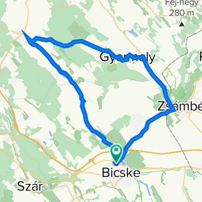 Kossuth utca 64, Bicske to Kossuth utca 64, Bicske
- Distance
- 43.7 km
- Ascent
- 112 m
- Descent
- 341 m
- Location
- Bicske, Fejér, Hungary
 Szülinapi kör - Zoli
- Distance
- 87.8 km
- Ascent
- 633 m
- Descent
- 645 m
- Location
- Bicske, Fejér, Hungary
 Etyekwood Hills forever
- Distance
- 53.1 km
- Ascent
- 268 m
- Descent
- 295 m
- Location
- Bicske, Fejér, Hungary
 Királyi-kör
- Distance
- 92.1 km
- Ascent
- 459 m
- Descent
- 459 m
- Location
- Bicske, Fejér, Hungary
 Alcsúti arborétum
- Distance
- 4.8 km
- Ascent
- 38 m
- Descent
- 38 m
- Location
- Bicske, Fejér, Hungary
 Bicske-Csákvár bejárótúrás
- Distance
- 101.7 km
- Ascent
- 998 m
- Descent
- 1,011 m
- Location
- Bicske, Fejér, Hungary
 Route in Felcsút
- Distance
- 101.8 km
- Ascent
- 565 m
- Descent
- 587 m
- Location
- Bicske, Fejér, Hungary
 Herceg - Bia- Felcsút 45 km Edzőkör
- Distance
- 45.8 km
- Ascent
- 324 m
- Descent
- 327 m
- Location
- Bicske, Fejér, Hungary
Open it in the app