

Rund um Schupfart
A cycling route starting in Wegenstetten, Canton of Aargau, Switzerland.
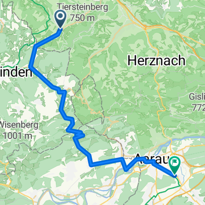
Overview
About this route
Tour around Schupfart, partly on paved roads, partly on steep trails. Very nice views!
- -:--
- Duration
- 21.5 km
- Distance
- 510 m
- Ascent
- 510 m
- Descent
- ---
- Avg. speed
- ---
- Max. altitude

Route quality
Waytypes & surfaces along the route
Waytypes
Track
12 km
(56 %)
Quiet road
8 km
(37 %)
Surfaces
Paved
9.2 km
(43 %)
Unpaved
8.6 km
(40 %)
Gravel
6.4 km
(30 %)
Asphalt
5.4 km
(25 %)
Continue with Bikemap
Use, edit, or download this cycling route
You would like to ride Rund um Schupfart or customize it for your own trip? Here is what you can do with this Bikemap route:
Free features
- Save this route as favorite or in collections
- Copy & plan your own version of this route
- Sync your route with Garmin or Wahoo
Premium features
Free trial for 3 days, or one-time payment. More about Bikemap Premium.
- Navigate this route on iOS & Android
- Export a GPX / KML file of this route
- Create your custom printout (try it for free)
- Download this route for offline navigation
Discover more Premium features.
Get Bikemap PremiumFrom our community
Other popular routes starting in Wegenstetten
 Go 4 It
- Distance
- 33.5 km
- Ascent
- 798 m
- Descent
- 797 m
- Location
- Wegenstetten, Canton of Aargau, Switzerland
 Schulstrasse 19, Hellikon nach Kellerackerstrasse 4–8, Stein AG
- Distance
- 14.4 km
- Ascent
- 151 m
- Descent
- 267 m
- Location
- Wegenstetten, Canton of Aargau, Switzerland
 Wegenstetten - Suhr AG
- Distance
- 28.4 km
- Ascent
- 160 m
- Descent
- 138 m
- Location
- Wegenstetten, Canton of Aargau, Switzerland
 Hauptstrasse 85, Wegenstetten nach Stadtweg 4, Rheinfelden
- Distance
- 14.6 km
- Ascent
- 12 m
- Descent
- 164 m
- Location
- Wegenstetten, Canton of Aargau, Switzerland
 Gründelenmatthof 360, Wegenstetten nach Marktplatz 9, Würzburg
- Distance
- 429.3 km
- Ascent
- 2,283 m
- Descent
- 2,609 m
- Location
- Wegenstetten, Canton of Aargau, Switzerland
 Talmatt 1, Wegenstetten nach Pappelnweg 2, Rheinfelden
- Distance
- 15.2 km
- Ascent
- 14 m
- Descent
- 175 m
- Location
- Wegenstetten, Canton of Aargau, Switzerland
 Hauptstrasse 85, Wegenstetten nach Rosenrain 2, Frick
- Distance
- 8.8 km
- Ascent
- 169 m
- Descent
- 260 m
- Location
- Wegenstetten, Canton of Aargau, Switzerland
 Rund um Schupfart
- Distance
- 21.5 km
- Ascent
- 510 m
- Descent
- 510 m
- Location
- Wegenstetten, Canton of Aargau, Switzerland
Open it in the app