

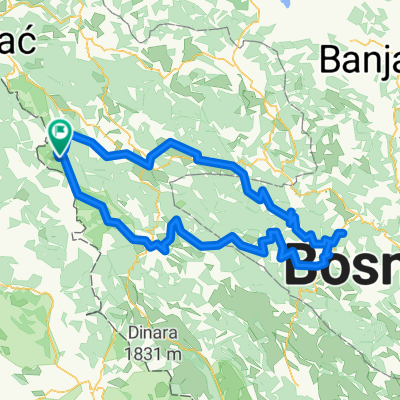
Bosnia Cicloturistica 1.1
A cycling route starting in Orašac, Federation of Bosnia and Herzegovina, Bosnia and Herzegovina.
Overview
About this route
Una - Sava - Danubio itinerario Bosniaco
Martin Brod - Kulen Vakuf - Bihac - Bosanska Krupa - Bosanski Novi Prijedor ovviamente poi da prijedor possiamo anche proseguire verso novi sad costeggiando il fiume Sava (quindi Prijedor-Dubica-Gradiska-Slavonski Brod) e poi il Danubio (magari facendo Slavonski Brod- Vukovar e poi Novi Sad-Belgrado). …- -:--
- Duration
- 610.7 km
- Distance
- 1,139 m
- Ascent
- 1,415 m
- Descent
- ---
- Avg. speed
- ---
- Max. altitude
Continue with Bikemap
Use, edit, or download this cycling route
You would like to ride Bosnia Cicloturistica 1.1 or customize it for your own trip? Here is what you can do with this Bikemap route:
Free features
- Save this route as favorite or in collections
- Copy & plan your own version of this route
- Split it into stages to create a multi-day tour
- Sync your route with Garmin or Wahoo
Premium features
Free trial for 3 days, or one-time payment. More about Bikemap Premium.
- Navigate this route on iOS & Android
- Export a GPX / KML file of this route
- Create your custom printout (try it for free)
- Download this route for offline navigation
Discover more Premium features.
Get Bikemap PremiumFrom our community
Other popular routes starting in Orašac
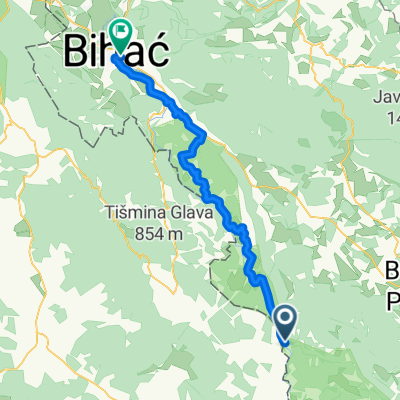 Martin brod-Bihać
- Distance
- 57 km
- Ascent
- 565 m
- Descent
- 656 m
- Location
- Orašac, Federation of Bosnia and Herzegovina, Bosnia and Herzegovina
 Bosnia Cicloturistica 1.1
- Distance
- 610.7 km
- Ascent
- 1,139 m
- Descent
- 1,415 m
- Location
- Orašac, Federation of Bosnia and Herzegovina, Bosnia and Herzegovina
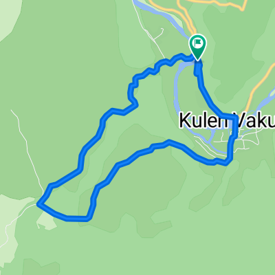 Ostrovica
- Distance
- 7.4 km
- Ascent
- 198 m
- Descent
- 197 m
- Location
- Orašac, Federation of Bosnia and Herzegovina, Bosnia and Herzegovina
 SEFF 2019.
- Distance
- 425.3 km
- Ascent
- 946 m
- Descent
- 1,130 m
- Location
- Orašac, Federation of Bosnia and Herzegovina, Bosnia and Herzegovina
 4 den 2/2
- Distance
- 43.8 km
- Ascent
- 681 m
- Descent
- 804 m
- Location
- Orašac, Federation of Bosnia and Herzegovina, Bosnia and Herzegovina
 Untitled route
- Distance
- 270.3 km
- Ascent
- 7,682 m
- Descent
- 7,683 m
- Location
- Orašac, Federation of Bosnia and Herzegovina, Bosnia and Herzegovina
 Šator planina
- Distance
- 203 km
- Ascent
- 4,014 m
- Descent
- 4,015 m
- Location
- Orašac, Federation of Bosnia and Herzegovina, Bosnia and Herzegovina
 Dag 238 (slutet)
- Distance
- 37.4 km
- Ascent
- 457 m
- Descent
- 524 m
- Location
- Orašac, Federation of Bosnia and Herzegovina, Bosnia and Herzegovina
Open it in the app