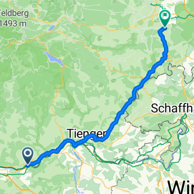
08 Laufenburg - Hemishofen
A cycling route starting in Laufenburg, Canton of Aargau, Switzerland.
Overview
About this route
stage 2 Rheinroute EV 2
- -:--
- Duration
- 97.4 km
- Distance
- 431 m
- Ascent
- 341 m
- Descent
- ---
- Avg. speed
- ---
- Max. altitude
Route quality
Waytypes & surfaces along the route
Waytypes
Quiet road
26.3 km
(27 %)
Road
25.3 km
(26 %)
Surfaces
Paved
80.9 km
(83 %)
Unpaved
12.7 km
(13 %)
Asphalt
80.9 km
(83 %)
Gravel
12.7 km
(13 %)
Undefined
3.9 km
(4 %)
Continue with Bikemap
Use, edit, or download this cycling route
You would like to ride 08 Laufenburg - Hemishofen or customize it for your own trip? Here is what you can do with this Bikemap route:
Free features
- Save this route as favorite or in collections
- Copy & plan your own version of this route
- Split it into stages to create a multi-day tour
- Sync your route with Garmin or Wahoo
Premium features
Free trial for 3 days, or one-time payment. More about Bikemap Premium.
- Navigate this route on iOS & Android
- Export a GPX / KML file of this route
- Create your custom printout (try it for free)
- Download this route for offline navigation
Discover more Premium features.
Get Bikemap PremiumFrom our community
Other popular routes starting in Laufenburg
- Rundfahrt durch den Jurapark ab Laufenburg CH
- Distance
- 26.5 km
- Ascent
- 290 m
- Descent
- 290 m
- Location
- Laufenburg, Canton of Aargau, Switzerland
- 2014-T16-Laufenburg-Glattfelden
- Distance
- 55.4 km
- Ascent
- 363 m
- Descent
- 334 m
- Location
- Laufenburg, Canton of Aargau, Switzerland
- 15_TORTOUR TS15-TS16
- Distance
- 55.5 km
- Ascent
- 363 m
- Descent
- 337 m
- Location
- Laufenburg, Canton of Aargau, Switzerland
- TORTOUR TS15-TS16
- Distance
- 41 km
- Ascent
- 226 m
- Descent
- 186 m
- Location
- Laufenburg, Canton of Aargau, Switzerland
- laufenburg - schaffhausen
- Distance
- 66.5 km
- Ascent
- 407 m
- Descent
- 311 m
- Location
- Laufenburg, Canton of Aargau, Switzerland
- Laufenburg - Schaffhausen
- Distance
- 59.3 km
- Ascent
- 208 m
- Descent
- 91 m
- Location
- Laufenburg, Canton of Aargau, Switzerland
- Hotzenwald
- Distance
- 16.9 km
- Ascent
- 438 m
- Descent
- 145 m
- Location
- Laufenburg, Canton of Aargau, Switzerland
- 2014-T16-Laufenburg-Glattfelden
- Distance
- 55.3 km
- Ascent
- 531 m
- Descent
- 472 m
- Location
- Laufenburg, Canton of Aargau, Switzerland
Open it in the app