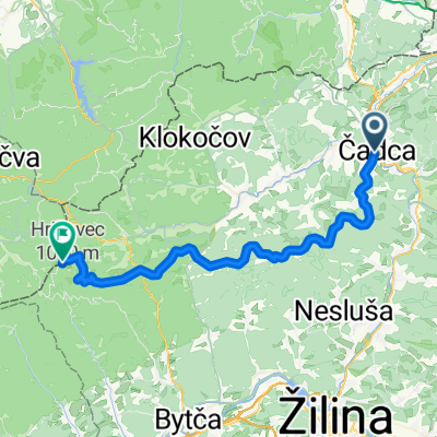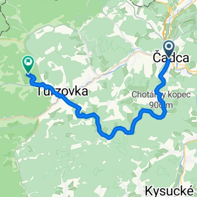
CA- St.Bystrica- s. Lutiška- Terchová / rozhľadňa
- 37.8 km
- 958 m
- 795 m
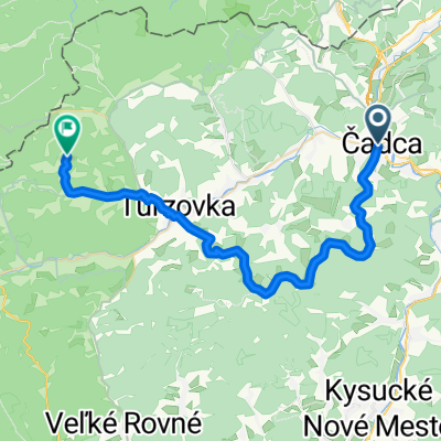
- Čadca, Žilina Region, Slovakia
A cycling route starting in Čadca, Žilina Region, Slovakia.
Overview
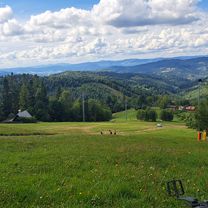
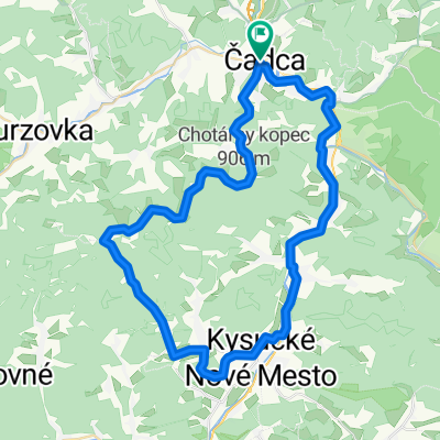
The route begins under Ośczadnica heading towards the center, where after the roundabout you turn left after 100 meters. The road is still asphalted, a bit damaged, but suitable also for a trekking bike. Continue like this for about 3 km uphill. Then you will pass an exit until you descend into the slope that will get you to Čadca. In Čadca you will pass Tesco, go straight through the intersection and turn right at the second possible turn. The turn will be after a gentle climb of about 500 meters. You will go down, continue along the main road, and at the end, turn left. From here, there is only the ascent to Hotel Husárik where you can refresh yourself. After a short break, if you've replenished your spent fluids, we continue on the gravel road for almost 1 km and turn left. We pass through a settlement of a few houses, a barking dog will surely alert you to it. Continue along the road you see, which will take you to the top of the hill. There will be tougher sections, bigger stones, and you will have to lean into the pedals. When you reach the top, you are on Chotárny Hill 906 m. From there, it’s just along the ridge and down. You will arrive in Krásno nad Kysucou, where along the asphalt road by the Kysuca river you will get back to Ośczadnica.
created this 12 years ago
Continue with Bikemap
You would like to ride cez Oscadnicu, Husarik, Chotárny kopec 906 m or customize it for your own trip? Here is what you can do with this Bikemap route:
Free trial for 3 days, or one-time payment. More about Bikemap Premium.
Discover more Premium features.
Get Bikemap PremiumFrom our community
Open it in the app