

Vom Marchfeld auf den Kahlenberg
A cycling route starting in Deutsch-Wagram, Lower Austria, Austria.
Overview
About this route
<p>
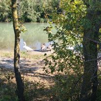
<strong>Beautiful bike tour with wonderful views.</strong></p>
<p>
From Deutsch Wagram along the Marchfeld Canal to the Danube, over the Nordsteg to Grinzingerstrasse. From now on it goes uphill via Sandgasse and Cobenzlgasse to Höhenstrasse. At the fork, turn right uphill to the large parking lot at Kahlenberg.<br />
Here are opportunities for rest.<br />
Departure via Höhenstrasse to Klosterneuburg. Through the town to Rollfährenstrasse, following it to the Danube.<br />
By ferry across the Danube, downstream along the Danube bike path to the dam at the Danube Island. Here turn left under the highway and then right onto the Marchfeld Canal bike path. Following this bike path all the way to Deutsch Wagram.</p>
Translated, show original (German)- -:--
- Duration
- 64.9 km
- Distance
- 347 m
- Ascent
- 347 m
- Descent
- ---
- Avg. speed
- ---
- Max. altitude

Route quality
Waytypes & surfaces along the route
Waytypes
Track
23.4 km
(36 %)
Cycleway
14.9 km
(23 %)
Surfaces
Paved
23.4 km
(36 %)
Unpaved
31.8 km
(49 %)
Asphalt
23.4 km
(36 %)
Loose gravel
20.1 km
(31 %)
Continue with Bikemap
Use, edit, or download this cycling route
You would like to ride Vom Marchfeld auf den Kahlenberg or customize it for your own trip? Here is what you can do with this Bikemap route:
Free features
- Save this route as favorite or in collections
- Copy & plan your own version of this route
- Sync your route with Garmin or Wahoo
Premium features
Free trial for 3 days, or one-time payment. More about Bikemap Premium.
- Navigate this route on iOS & Android
- Export a GPX / KML file of this route
- Create your custom printout (try it for free)
- Download this route for offline navigation
Discover more Premium features.
Get Bikemap PremiumFrom our community
Other popular routes starting in Deutsch-Wagram
 Deutsch Wagram (Bahnhof) - Gänserndorf (Porschgasse)
- Distance
- 15.2 km
- Ascent
- 12 m
- Descent
- 12 m
- Location
- Deutsch-Wagram, Lower Austria, Austria
 Dampfross und Drahtesel von Deutsch Wagram startend
- Distance
- 44.5 km
- Ascent
- 49 m
- Descent
- 46 m
- Location
- Deutsch-Wagram, Lower Austria, Austria
 Radwandertag NFDeutschWagram2015
- Distance
- 19.3 km
- Ascent
- 0 m
- Descent
- 0 m
- Location
- Deutsch-Wagram, Lower Austria, Austria
 Deutsch Wagram - Wolkersdorf 67 km
- Distance
- 67.7 km
- Ascent
- 272 m
- Descent
- 254 m
- Location
- Deutsch-Wagram, Lower Austria, Austria
 Marchfeld. - Donaukanalrunde
- Distance
- 62.1 km
- Ascent
- 57 m
- Descent
- 56 m
- Location
- Deutsch-Wagram, Lower Austria, Austria
 Babenberger Tulbinger Kogel Sophienalpe
- Distance
- 108.6 km
- Ascent
- 843 m
- Descent
- 843 m
- Location
- Deutsch-Wagram, Lower Austria, Austria
 Mozartgasse nach Mozartgasse
- Distance
- 54 km
- Ascent
- 166 m
- Descent
- 215 m
- Location
- Deutsch-Wagram, Lower Austria, Austria
 Durch das Marchfeld auf den Braunsberg
- Distance
- 48.5 km
- Ascent
- 193 m
- Descent
- 26 m
- Location
- Deutsch-Wagram, Lower Austria, Austria
Open it in the app