

Waldershof
A cycling route starting in Aš, Karlovarský kraj, Czechia.
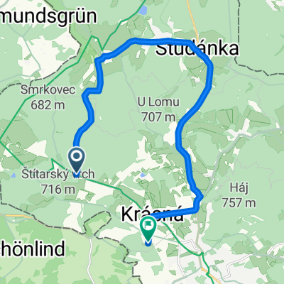
Overview
About this route
Na Zoigla na hranice Horních Frank a Horní Falce
- -:--
- Duration
- 38.5 km
- Distance
- 357 m
- Ascent
- 458 m
- Descent
- ---
- Avg. speed
- ---
- Max. altitude
Route quality
Waytypes & surfaces along the route
Waytypes
Quiet road
15 km
(39 %)
Track
11.4 km
(30 %)
Surfaces
Paved
16.4 km
(43 %)
Unpaved
10.8 km
(28 %)
Asphalt
11.6 km
(30 %)
Ground
5.3 km
(14 %)
Continue with Bikemap
Use, edit, or download this cycling route
You would like to ride Waldershof or customize it for your own trip? Here is what you can do with this Bikemap route:
Free features
- Save this route as favorite or in collections
- Copy & plan your own version of this route
- Sync your route with Garmin or Wahoo
Premium features
Free trial for 3 days, or one-time payment. More about Bikemap Premium.
- Navigate this route on iOS & Android
- Export a GPX / KML file of this route
- Create your custom printout (try it for free)
- Download this route for offline navigation
Discover more Premium features.
Get Bikemap PremiumFrom our community
Other popular routes starting in Aš
 2013.05.18. stezka mostů bike
- Distance
- 53.8 km
- Ascent
- 349 m
- Descent
- 365 m
- Location
- Aš, Karlovarský kraj, Czechia
 Od Aše po Jablunkov - celá trasa
- Distance
- 651.3 km
- Ascent
- 1,427 m
- Descent
- 1,683 m
- Location
- Aš, Karlovarský kraj, Czechia
 Neuhausen-Cz-Vogtland 20.9.09
- Distance
- 59 km
- Ascent
- 596 m
- Descent
- 672 m
- Location
- Aš, Karlovarský kraj, Czechia
 Aš - Břeclav
- Distance
- 641.9 km
- Ascent
- 2,297 m
- Descent
- 2,781 m
- Location
- Aš, Karlovarský kraj, Czechia
 Nový soubor 1
- Distance
- 1,269.2 km
- Ascent
- 16,484 m
- Descent
- 16,464 m
- Location
- Aš, Karlovarský kraj, Czechia
 Aš - Vogtland - Aš I.
- Distance
- 71 km
- Ascent
- 1,020 m
- Descent
- 1,124 m
- Location
- Aš, Karlovarský kraj, Czechia
 Nedělní bajkovka
- Distance
- 49.5 km
- Ascent
- 899 m
- Descent
- 821 m
- Location
- Aš, Karlovarský kraj, Czechia
 1111
1111- Distance
- 13.9 km
- Ascent
- 218 m
- Descent
- 244 m
- Location
- Aš, Karlovarský kraj, Czechia
Open it in the app