MAGREDI
A cycling route starting in Scomigo, Veneto, Italy.
Overview
About this route
STRADA PER CANTINE APERTE
- -:--
- Duration
- 101.7 km
- Distance
- 318 m
- Ascent
- 304 m
- Descent
- ---
- Avg. speed
- ---
- Avg. speed
Route quality
Waytypes & surfaces along the route
Waytypes
Busy road
54 km
(53 %)
Road
21.5 km
(21 %)
Surfaces
Paved
63 km
(62 %)
Unpaved
0.8 km
(<1 %)
Asphalt
60.1 km
(59 %)
Paved (undefined)
3 km
(3 %)
Route highlights
Points of interest along the route
Point of interest after 57.6 km
BOBO
Continue with Bikemap
Use, edit, or download this cycling route
You would like to ride MAGREDI or customize it for your own trip? Here is what you can do with this Bikemap route:
Free features
- Save this route as favorite or in collections
- Copy & plan your own version of this route
- Sync your route with Garmin or Wahoo
Premium features
Free trial for 3 days, or one-time payment. More about Bikemap Premium.
- Navigate this route on iOS & Android
- Export a GPX / KML file of this route
- Create your custom printout (try it for free)
- Download this route for offline navigation
Discover more Premium features.
Get Bikemap PremiumFrom our community
Other popular routes starting in Scomigo
- Uscita del 22-03-2014
- Distance
- 82.5 km
- Ascent
- 856 m
- Descent
- 856 m
- Location
- Scomigo, Veneto, Italy
- San Lorenzo - Laghi di Revine - San Lorenzo -Vittorio Veneto
- Distance
- 41.8 km
- Ascent
- 677 m
- Descent
- 678 m
- Location
- Scomigo, Veneto, Italy
- I fiumi di Vittorio Veneto e l'alta via n°6
- Distance
- 40 km
- Ascent
- 771 m
- Descent
- 775 m
- Location
- Scomigo, Veneto, Italy
- 2018-03-belumat
- Distance
- 60.6 km
- Ascent
- 1,100 m
- Descent
- 1,097 m
- Location
- Scomigo, Veneto, Italy
- MAGREDI
- Distance
- 101.7 km
- Ascent
- 318 m
- Descent
- 304 m
- Location
- Scomigo, Veneto, Italy
- BAA - 5 - Conegliano - Valdobbiadene - Pieve di Soligo
- Distance
- 72.7 km
- Ascent
- 675 m
- Descent
- 688 m
- Location
- Scomigo, Veneto, Italy
- Vittorio S.Boldo Valmorel Nevegal Fadalto
- Distance
- 80.2 km
- Ascent
- 2,244 m
- Descent
- 2,212 m
- Location
- Scomigo, Veneto, Italy
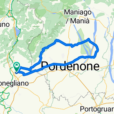
- Monte Altare Via dell'acqua sentieri di Piai n° 2
- Distance
- 33.5 km
- Ascent
- 640 m
- Descent
- 636 m
- Location
- Scomigo, Veneto, Italy
Open it in the app