

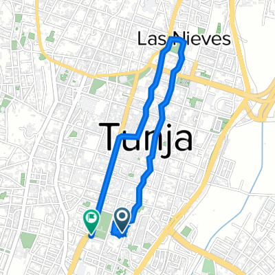
Tunja - Bogotá
A cycling route starting in Tunja, Departamento de Boyacá, Colombia.
Overview
About this route
Etapa con un recorrido sinuoso y final fuerte
- -:--
- Duration
- 155.9 km
- Distance
- 1,094 m
- Ascent
- 1,237 m
- Descent
- ---
- Avg. speed
- ---
- Avg. speed
Continue with Bikemap
Use, edit, or download this cycling route
You would like to ride Tunja - Bogotá or customize it for your own trip? Here is what you can do with this Bikemap route:
Free features
- Save this route as favorite or in collections
- Copy & plan your own version of this route
- Split it into stages to create a multi-day tour
- Sync your route with Garmin or Wahoo
Premium features
Free trial for 3 days, or one-time payment. More about Bikemap Premium.
- Navigate this route on iOS & Android
- Export a GPX / KML file of this route
- Create your custom printout (try it for free)
- Download this route for offline navigation
Discover more Premium features.
Get Bikemap PremiumFrom our community
Other popular routes starting in Tunja
 De Carrera 1a Este, Tunja a Avenida Universitaria 40-28, Tunja
- Distance
- 23.6 km
- Ascent
- 345 m
- Descent
- 357 m
- Location
- Tunja, Departamento de Boyacá, Colombia
 Sachica
- Distance
- 64.2 km
- Ascent
- 1,367 m
- Descent
- 1,355 m
- Location
- Tunja, Departamento de Boyacá, Colombia
 De Calle 1 A Sur 5-8, Tunja a Calle 1 A Sur 5-8, Tunja
- Distance
- 89.4 km
- Ascent
- 1,475 m
- Descent
- 1,526 m
- Location
- Tunja, Departamento de Boyacá, Colombia
 De Carrera 6 42-57, Tunja a Carrera 5 2013, Tunja
- Distance
- 76.5 km
- Ascent
- 1,268 m
- Descent
- 1,198 m
- Location
- Tunja, Departamento de Boyacá, Colombia
 Al Puente De Boyaca
- Distance
- 38.5 km
- Ascent
- 805 m
- Descent
- 805 m
- Location
- Tunja, Departamento de Boyacá, Colombia
 De Carrera 9a 14-06, Tunja a Calle 13 10-91, Tunja
- Distance
- 5.5 km
- Ascent
- 56 m
- Descent
- 55 m
- Location
- Tunja, Departamento de Boyacá, Colombia
 Tunja-Motavita
- Distance
- 6.9 km
- Ascent
- 229 m
- Descent
- 209 m
- Location
- Tunja, Departamento de Boyacá, Colombia
 Nuevo Colón
- Distance
- 64.9 km
- Ascent
- 1,433 m
- Descent
- 1,412 m
- Location
- Tunja, Departamento de Boyacá, Colombia
Open it in the app