Taubensuhl-NF-FBTHütte
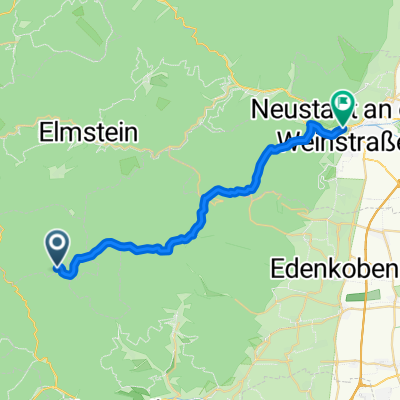
A cycling route starting in Eußerthal, Rhineland-Palatinate, Germany.
Overview
About this route
Second route Taubensuhl-NF-FBTHütte
- -:--
- Duration
- 24.4 km
- Distance
- 181 m
- Ascent
- 391 m
- Descent
- ---
- Avg. speed
- ---
- Max. altitude
Route quality
Waytypes & surfaces along the route
Waytypes
Track
16.6 km
(68 %)
Path
2.2 km
(9 %)
Surfaces
Paved
6.6 km
(27 %)
Unpaved
15.2 km
(62 %)
Gravel
12 km
(49 %)
Asphalt
5.4 km
(22 %)
Continue with Bikemap
Use, edit, or download this cycling route
You would like to ride Taubensuhl-NF-FBTHütte or customize it for your own trip? Here is what you can do with this Bikemap route:
Free features
- Save this route as favorite or in collections
- Copy & plan your own version of this route
- Sync your route with Garmin or Wahoo
Premium features
Free trial for 3 days, or one-time payment. More about Bikemap Premium.
- Navigate this route on iOS & Android
- Export a GPX / KML file of this route
- Create your custom printout (try it for free)
- Download this route for offline navigation
Discover more Premium features.
Get Bikemap PremiumFrom our community
Other popular routes starting in Eußerthal
Taubensuhl-NF-FBTHütte- Distance
- 24.4 km
- Ascent
- 181 m
- Descent
- 391 m
- Location
- Eußerthal, Rhineland-Palatinate, Germany
Taubensuhl - LD- Distance
- 30.2 km
- Ascent
- 258 m
- Descent
- 619 m
- Location
- Eußerthal, Rhineland-Palatinate, Germany
Taubensuhl Bergzeitfahren- Distance
- 6.6 km
- Ascent
- 439 m
- Descent
- 130 m
- Location
- Eußerthal, Rhineland-Palatinate, Germany
Von Platz Nr. 5 in Eußerthal zum Platz Nr. 6 am Modenbacher Hof- Distance
- 16.4 km
- Ascent
- 691 m
- Descent
- 609 m
- Location
- Eußerthal, Rhineland-Palatinate, Germany
10-MRZ-12- Distance
- 13.2 km
- Ascent
- 567 m
- Descent
- 569 m
- Location
- Eußerthal, Rhineland-Palatinate, Germany
Rheinebenetour Eußerthal Wörth zurück über Hörth und Bellheim- Distance
- 98 km
- Ascent
- 175 m
- Descent
- 168 m
- Location
- Eußerthal, Rhineland-Palatinate, Germany
Heldenstein, Taubensuhl, Helmbachweyher...Heldenstein- Distance
- 27.2 km
- Ascent
- 452 m
- Descent
- 452 m
- Location
- Eußerthal, Rhineland-Palatinate, Germany
Taubensuhl-Kalmit- Distance
- 32.7 km
- Ascent
- 631 m
- Descent
- 998 m
- Location
- Eußerthal, Rhineland-Palatinate, Germany
Open it in the app


