

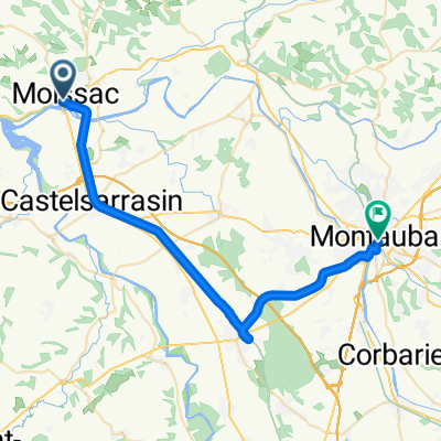
EV3.2 Moissac-Toulouse
A cycling route starting in Moissac, Occitanie, France.
Overview
About this route
Von Moissac nach Toulouse auf der EuroVelo 3
- -:--
- Duration
- 69.1 km
- Distance
- 88 m
- Ascent
- 18 m
- Descent
- ---
- Avg. speed
- ---
- Max. altitude

Route quality
Waytypes & surfaces along the route
Waytypes
Cycleway
45.6 km
(66 %)
Path
15.2 km
(22 %)
Surfaces
Paved
53.9 km
(78 %)
Unpaved
6.2 km
(9 %)
Asphalt
50.5 km
(73 %)
Gravel
6.2 km
(9 %)
Continue with Bikemap
Use, edit, or download this cycling route
You would like to ride EV3.2 Moissac-Toulouse or customize it for your own trip? Here is what you can do with this Bikemap route:
Free features
- Save this route as favorite or in collections
- Copy & plan your own version of this route
- Sync your route with Garmin or Wahoo
Premium features
Free trial for 3 days, or one-time payment. More about Bikemap Premium.
- Navigate this route on iOS & Android
- Export a GPX / KML file of this route
- Create your custom printout (try it for free)
- Download this route for offline navigation
Discover more Premium features.
Get Bikemap PremiumFrom our community
Other popular routes starting in Moissac
 Moissac - Toulouse
- Distance
- 67.4 km
- Ascent
- 158 m
- Descent
- 81 m
- Location
- Moissac, Occitanie, France
 Moissac / Montauban
- Distance
- 36.3 km
- Ascent
- 76 m
- Descent
- 65 m
- Location
- Moissac, Occitanie, France
 Rue Malaveille, Moissac to Rue de l'Église, Castelnau-d'Estrétefonds
- Distance
- 46 km
- Ascent
- 93 m
- Descent
- 51 m
- Location
- Moissac, Occitanie, France
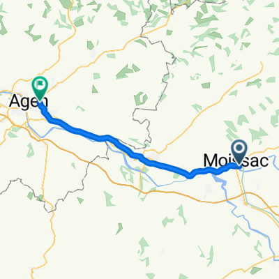 Moissac - Agen
- Distance
- 42 km
- Ascent
- 47 m
- Descent
- 68 m
- Location
- Moissac, Occitanie, France
 Rue du Pont, Moissac to Place de la Couronne, Marmande
- Distance
- 110.6 km
- Ascent
- 330 m
- Descent
- 368 m
- Location
- Moissac, Occitanie, France
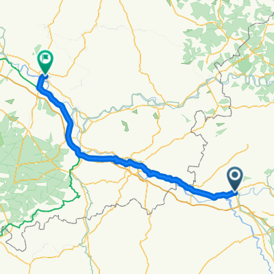
 ETAPA 5: CANAL DU MIDI
- Distance
- 52 km
- Ascent
- 49 m
- Descent
- 68 m
- Location
- Moissac, Occitanie, France
 EV3.2 Moissac-Toulouse
- Distance
- 7.1 km
- Ascent
- 32 m
- Descent
- 23 m
- Location
- Moissac, Occitanie, France
 Moissac-St.Nicholas de la Grave
- Distance
- 10.3 km
- Ascent
- 42 m
- Descent
- 47 m
- Location
- Moissac, Occitanie, France
Open it in the app