
ŽELEZNÝ DRAK 2013
A cycling route starting in Zlaté Hory, Olomoucký kraj, Czechia.
Overview
About this route
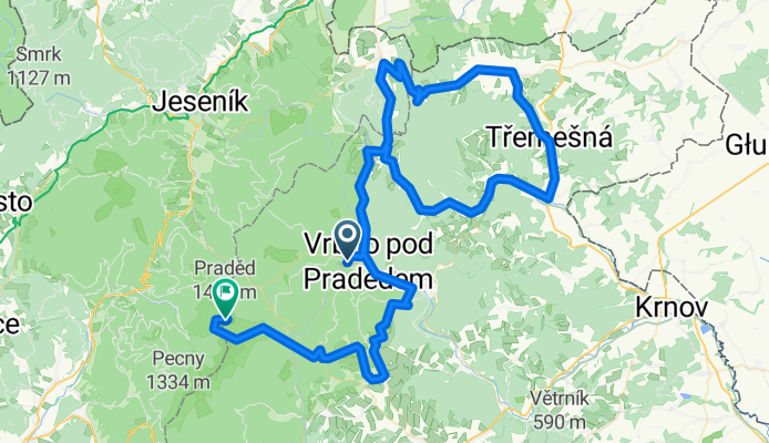
Tradiční cyklistická jízda pořádaná ACS DRAK Vrbno 27.7.2013 od 9 00. Start tradičně u Úpravny vody ve Vrbně pod Pradědem a cíl na Pradědu, nejvyšším vrcholu Moravy.
- -:--
- Duration
- 108.1 km
- Distance
- 1,937 m
- Ascent
- 1,012 m
- Descent
- ---
- Avg. speed
- ---
- Avg. speed
Route quality
Waytypes & surfaces along the route
Waytypes
Busy road
69.3 km
(64 %)
Road
33.8 km
(31 %)
Surfaces
Paved
79.7 km
(74 %)
Asphalt
79.7 km
(74 %)
Undefined
28.4 km
(26 %)
Continue with Bikemap
Use, edit, or download this cycling route
You would like to ride ŽELEZNÝ DRAK 2013 or customize it for your own trip? Here is what you can do with this Bikemap route:
Free features
- Save this route as favorite or in collections
- Copy & plan your own version of this route
- Split it into stages to create a multi-day tour
- Sync your route with Garmin or Wahoo
Premium features
Free trial for 3 days, or one-time payment. More about Bikemap Premium.
- Navigate this route on iOS & Android
- Export a GPX / KML file of this route
- Create your custom printout (try it for free)
- Download this route for offline navigation
Discover more Premium features.
Get Bikemap PremiumFrom our community
Other popular routes starting in Zlaté Hory
 Slezským Osoblažskem na kole-www.nomad.cz
- Distance
- 295.2 km
- Ascent
- 835 m
- Descent
- 889 m
- Location
- Zlaté Hory, Olomoucký kraj, Czechia
 Morning Glory 'round Biskupia Kopa
- Distance
- 29.3 km
- Ascent
- 800 m
- Descent
- 806 m
- Location
- Zlaté Hory, Olomoucký kraj, Czechia
 Z Valštejna do Mnichova na pstruha a pár piv
- Distance
- 25.1 km
- Ascent
- 298 m
- Descent
- 270 m
- Location
- Zlaté Hory, Olomoucký kraj, Czechia
 Aspen Frühstück ;)
- Distance
- 18.4 km
- Ascent
- 663 m
- Descent
- 637 m
- Location
- Zlaté Hory, Olomoucký kraj, Czechia
 HomePass-Downhill
- Distance
- 13.7 km
- Ascent
- 497 m
- Descent
- 512 m
- Location
- Zlaté Hory, Olomoucký kraj, Czechia
 HomePass-Downhill
- Distance
- 13.6 km
- Ascent
- 622 m
- Descent
- 632 m
- Location
- Zlaté Hory, Olomoucký kraj, Czechia
 Reviz-Jesenik-Karlova-Vrbno
- Distance
- 68.3 km
- Ascent
- 1,338 m
- Descent
- 1,336 m
- Location
- Zlaté Hory, Olomoucký kraj, Czechia
 Hermanovice_Albrechtice_47_930_1200
- Distance
- 47.1 km
- Ascent
- 1,034 m
- Descent
- 1,306 m
- Location
- Zlaté Hory, Olomoucký kraj, Czechia
Open it in the app