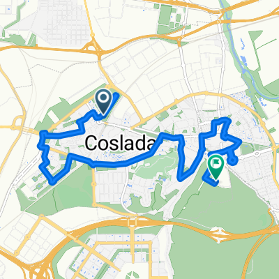
Coslada - La Guardia
- 94.2 km
- 777 m
- 755 m
- Coslada, Madrid, Spain
A cycling route starting in Coslada, Madrid, Spain.
Overview
Route of approximately 80 km. It can be done in 5 hours, with several stops, and at an average of 20 km/h. Two flat sections and one leg-breaker, precisely the one from Soto de Viñuelas.
created this 12 years ago
Route quality
Track
52.6 km
67 %
Path
7.8 km
10 %
Paved
15.7 km
(20 %)
Unpaved
48.7 km
(62 %)
Gravel
25.9 km
33 %
Ground
22.8 km
29 %
Route highlights
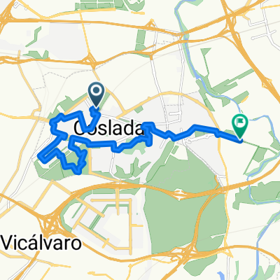
Salimos de Coslada por la Avenida de San Pablo.
Hacemos como si nos incorporásemos a la A2 en dirección Madrid pero antes nos salimos por el camino de la Muñoza.
Seguiremos por el camino paralelo al río
Seguiremos por la pistas que siguen paralelas al río Jarama.
Pasamos por debajo de la A1 y seguimos de frente hasta toparnos con la valla del Soto de Viñuelas.
A partir de aquí la ruta es relativamente sencilla. Seguiremos siempre por las pistas que circulan paralelas a la valla del Soto de Viñuelas.
Cuando entramos en urbanizaciones como la de Fuente del Fresno buscaremos la calle que vaya girando hacia la izquierda, lógicamente paralela a la valla.
Pasamos junto a un vértice geodésico y entramos en otra urbanización por un tramo asfaltado. Como siempre, optaremos por las calles que vayan girando hacia la izquierda.
Al final de esta calle sin salida continúa nuestro sendero.
Entretenido y estrecho sendero. Cuidado con los que vienen de frente.
La pista vuelve a ensancharse. Como siempre, con la valla a la izquierda como referencia.
Depuradora. Entramos en Tres Cantos. Seguiremos por los senderos paralelos a la valla, no por el carril bici.
Carretera de Colmenar. Nosotros seguimos por el carril de deceleración para, 300 metros adelante, meternos por un sendero paralelo al quitamiedos. Quizás lo más sensato sea cruzar la carretera por un puente que hay 100 metros a la derecha para volver a cruzar la carrretera 300 metros más adelante.
La pista se dirige hacia el Tanatorio de Tres Cantos.
Seguiremos paralelos a la valla del Soto de Viñuelas, siempre a nuestra izquierda.
Tras un fuerte descenso, con su consiguiente subida, giraremos en el siguiente cruce a la izquierda para sobrepasar una tapia de piedra y seguir con la valla a nuestra izquierda.
Franqueamos la tapia de salida y descendemos hacia el arroyo de Viñuelas.
Tras el descenso, seguiremos por la pista asfaltada hasta encontrarnos un puente de madera. Lo cruzamos y volvemos por donde vinimos.
Antes de enfilar la recta que nos llevaría a la carretera que sube hacia Algete, giramos a nuestra izquierda.
Primer paso por encima del Arroyo Viñuelas
Bifurcación antes de llegar a la M50. Seguimos por la derecha.
Puente bajo la carretera que une el Aeropuerto de Madrid con Paracuellos.
Continue with Bikemap
You would like to ride Coslada - Soto de Viñuelas - Coslada or customize it for your own trip? Here is what you can do with this Bikemap route:
Free trial for 3 days, or one-time payment. More about Bikemap Premium.
Discover more Premium features.
Get Bikemap PremiumFrom our community
Open it in the app