
2013 PMSL 005
A cycling route starting in Mainburg, Bavaria, Germany.
Overview
About this route
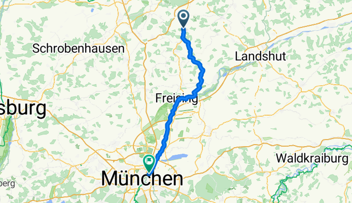
Mainburg - Freising - MUNCHEN (Herzogpark)
- -:--
- Duration
- 70.7 km
- Distance
- 292 m
- Ascent
- 213 m
- Descent
- ---
- Avg. speed
- ---
- Max. altitude

Route quality
Waytypes & surfaces along the route
Waytypes
Track
19.8 km
(28 %)
Quiet road
18.4 km
(26 %)
Surfaces
Paved
33.2 km
(47 %)
Unpaved
31.1 km
(44 %)
Asphalt
32.5 km
(46 %)
Gravel
19.1 km
(27 %)
Continue with Bikemap
Use, edit, or download this cycling route
You would like to ride 2013 PMSL 005 or customize it for your own trip? Here is what you can do with this Bikemap route:
Free features
- Save this route as favorite or in collections
- Copy & plan your own version of this route
- Sync your route with Garmin or Wahoo
Premium features
Free trial for 3 days, or one-time payment. More about Bikemap Premium.
- Navigate this route on iOS & Android
- Export a GPX / KML file of this route
- Create your custom printout (try it for free)
- Download this route for offline navigation
Discover more Premium features.
Get Bikemap PremiumFrom our community
Other popular routes starting in Mainburg
 Kurzstrecke
- Distance
- 11.5 km
- Ascent
- 235 m
- Descent
- 249 m
- Location
- Mainburg, Bavaria, Germany
 MAI-ERG
- Distance
- 37.9 km
- Ascent
- 401 m
- Descent
- 425 m
- Location
- Mainburg, Bavaria, Germany
 SZ-6a_Mainburg_Markt Indersdorf_60,7km 340hm
- Distance
- 60.9 km
- Ascent
- 385 m
- Descent
- 341 m
- Location
- Mainburg, Bavaria, Germany
 St-Georg-Straße, Attenhofen nach Kirchweg, Attenhofen
- Distance
- 7 km
- Ascent
- 85 m
- Descent
- 79 m
- Location
- Mainburg, Bavaria, Germany
 Hit Erding
- Distance
- 48.9 km
- Ascent
- 416 m
- Descent
- 389 m
- Location
- Mainburg, Bavaria, Germany
 2013 PMSL 005
- Distance
- 70.7 km
- Ascent
- 292 m
- Descent
- 213 m
- Location
- Mainburg, Bavaria, Germany
 2. Etappe Mainburg - Grünbach
- Distance
- 48.9 km
- Ascent
- 217 m
- Descent
- 179 m
- Location
- Mainburg, Bavaria, Germany
 leichte Hallertautour
- Distance
- 88.4 km
- Ascent
- 390 m
- Descent
- 398 m
- Location
- Mainburg, Bavaria, Germany
Open it in the app