

Saaleradweg Etappe 2
A cycling route starting in Hohenwarte, Thuringia, Germany.
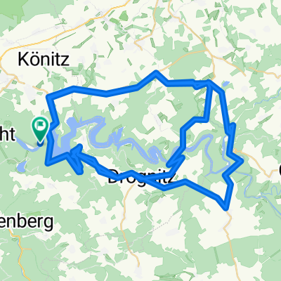
Overview
About this route
Stage 2, 135Km according to the odometer, with partially very bad roads
- -:--
- Duration
- 122.5 km
- Distance
- 251 m
- Ascent
- 589 m
- Descent
- ---
- Avg. speed
- ---
- Max. altitude
Route quality
Waytypes & surfaces along the route
Waytypes
Road
23.3 km
(19 %)
Quiet road
19.6 km
(16 %)
Surfaces
Paved
89.4 km
(73 %)
Unpaved
14.7 km
(12 %)
Asphalt
88.2 km
(72 %)
Ground
6.1 km
(5 %)
Route highlights
Points of interest along the route
Point of interest after 0 km
Übernachtung von 1. Etappe
Point of interest after 109.6 km
Weinanbaugebiet
Point of interest after 122.5 km
Campingplatz Naumburg, beim Zelten hört man die Züge ziemlich laut
Continue with Bikemap
Use, edit, or download this cycling route
You would like to ride Saaleradweg Etappe 2 or customize it for your own trip? Here is what you can do with this Bikemap route:
Free features
- Save this route as favorite or in collections
- Copy & plan your own version of this route
- Split it into stages to create a multi-day tour
- Sync your route with Garmin or Wahoo
Premium features
Free trial for 3 days, or one-time payment. More about Bikemap Premium.
- Navigate this route on iOS & Android
- Export a GPX / KML file of this route
- Create your custom printout (try it for free)
- Download this route for offline navigation
Discover more Premium features.
Get Bikemap PremiumFrom our community
Other popular routes starting in Hohenwarte
 Saaleradweg Etappe 2
- Distance
- 122.5 km
- Ascent
- 251 m
- Descent
- 589 m
- Location
- Hohenwarte, Thuringia, Germany
 hw2007
- Distance
- 21.3 km
- Ascent
- 482 m
- Descent
- 482 m
- Location
- Hohenwarte, Thuringia, Germany
 SAALE_03_Hohenwartestausee_Kahla_
- Distance
- 56.3 km
- Ascent
- 333 m
- Descent
- 463 m
- Location
- Hohenwarte, Thuringia, Germany
 Saaleradweg Etappe 2
- Distance
- 122.4 km
- Ascent
- 771 m
- Descent
- 1,076 m
- Location
- Hohenwarte, Thuringia, Germany
 rund um den hohenwartestausee
- Distance
- 81.7 km
- Ascent
- 1,188 m
- Descent
- 1,206 m
- Location
- Hohenwarte, Thuringia, Germany
 Hohenwarte-Runde CLONED FROM ROUTE 87251
- Distance
- 47.4 km
- Ascent
- 961 m
- Descent
- 961 m
- Location
- Hohenwarte, Thuringia, Germany
 saale 3
- Distance
- 82.3 km
- Ascent
- 288 m
- Descent
- 416 m
- Location
- Hohenwarte, Thuringia, Germany
 L2385, Hohenwarte nach L2385, Hohenwarte
- Distance
- 68.3 km
- Ascent
- 4,738 m
- Descent
- 4,738 m
- Location
- Hohenwarte, Thuringia, Germany
Open it in the app