
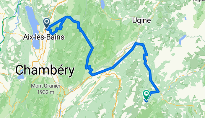
Gresy sur Aix - Valmorel
A cycling route starting in Grésy-sur-Aix, Auvergne-Rhône-Alpes, France.
Overview
About this route
5th Dauphiné
- -:--
- Duration
- 143.5 km
- Distance
- 2,300 m
- Ascent
- 1,252 m
- Descent
- ---
- Avg. speed
- ---
- Max. altitude

Route quality
Waytypes & surfaces along the route
Waytypes
Road
24.4 km
(17 %)
Quiet road
2.9 km
(2 %)
Surfaces
Paved
80.4 km
(56 %)
Asphalt
78.9 km
(55 %)
Paved (undefined)
1.4 km
(1 %)
Undefined
63.1 km
(44 %)
Continue with Bikemap
Use, edit, or download this cycling route
You would like to ride Gresy sur Aix - Valmorel or customize it for your own trip? Here is what you can do with this Bikemap route:
Free features
- Save this route as favorite or in collections
- Copy & plan your own version of this route
- Split it into stages to create a multi-day tour
- Sync your route with Garmin or Wahoo
Premium features
Free trial for 3 days, or one-time payment. More about Bikemap Premium.
- Navigate this route on iOS & Android
- Export a GPX / KML file of this route
- Create your custom printout (try it for free)
- Download this route for offline navigation
Discover more Premium features.
Get Bikemap PremiumFrom our community
Other popular routes starting in Grésy-sur-Aix
 sortie JCB
- Distance
- 82.7 km
- Ascent
- 926 m
- Descent
- 927 m
- Location
- Grésy-sur-Aix, Auvergne-Rhône-Alpes, France
 St.Jean-de-Mnne/Dauphiné '14: Aix-les-Bains - MontRevard - Aix
- Distance
- 67.8 km
- Ascent
- 1,303 m
- Descent
- 1,303 m
- Location
- Grésy-sur-Aix, Auvergne-Rhône-Alpes, France
 Camping Marlice 65 km
- Distance
- 65.4 km
- Ascent
- 1,569 m
- Descent
- 1,568 m
- Location
- Grésy-sur-Aix, Auvergne-Rhône-Alpes, France
 Tour de la Suisse Juin 2020
- Distance
- 1,255.2 km
- Ascent
- 6,257 m
- Descent
- 6,251 m
- Location
- Grésy-sur-Aix, Auvergne-Rhône-Alpes, France
 2 aix le bain-St.Egreve 92
- Distance
- 92 km
- Ascent
- 430 m
- Descent
- 529 m
- Location
- Grésy-sur-Aix, Auvergne-Rhône-Alpes, France
 Gresy sur Aix - Valmorel
- Distance
- 143.5 km
- Ascent
- 2,300 m
- Descent
- 1,252 m
- Location
- Grésy-sur-Aix, Auvergne-Rhône-Alpes, France
 Gresy sur Aix - Le Revard
- Distance
- 58.3 km
- Ascent
- 1,239 m
- Descent
- 1,240 m
- Location
- Grésy-sur-Aix, Auvergne-Rhône-Alpes, France
 GRESY 6 4 13
- Distance
- 71.1 km
- Ascent
- 542 m
- Descent
- 542 m
- Location
- Grésy-sur-Aix, Auvergne-Rhône-Alpes, France
Open it in the app