

Lingenfeld-Rhodt-Weinstrasse nach Süden bis Kl.Münster-Lingenfeld
A cycling route starting in Lingenfeld, Rhineland-Palatinate, Germany.
Overview
About this route
I rode this tour in May. First, it goes through various towns (including Freisbach, Edesheim) to Rhodt on the Wine Road. Then along the Wine Road south to Klingenmünster. Now back towards the Rhine via Billigheim, Rohrbach, Insheim, Offenbach, Bellheim, Westheim to Lingenfeld.
Between Birkweiler and Kl. Münster, there are a few short climbs that are suitable for everyone.
- -:--
- Duration
- 74.8 km
- Distance
- 472 m
- Ascent
- 461 m
- Descent
- ---
- Avg. speed
- 270 m
- Max. altitude

Route quality
Waytypes & surfaces along the route
Waytypes
Track
16.5 km
(22 %)
Road
5.2 km
(7 %)
Surfaces
Paved
65.1 km
(87 %)
Unpaved
3.7 km
(5 %)
Asphalt
56.8 km
(76 %)
Paved (undefined)
6.7 km
(9 %)
Continue with Bikemap
Use, edit, or download this cycling route
You would like to ride Lingenfeld-Rhodt-Weinstrasse nach Süden bis Kl.Münster-Lingenfeld or customize it for your own trip? Here is what you can do with this Bikemap route:
Free features
- Save this route as favorite or in collections
- Copy & plan your own version of this route
- Sync your route with Garmin or Wahoo
Premium features
Free trial for 3 days, or one-time payment. More about Bikemap Premium.
- Navigate this route on iOS & Android
- Export a GPX / KML file of this route
- Create your custom printout (try it for free)
- Download this route for offline navigation
Discover more Premium features.
Get Bikemap PremiumFrom our community
Other popular routes starting in Lingenfeld
 Lingenfeld- Wörth und zurück -abseits des Pkw-Verkehrs-
- Distance
- 71.4 km
- Ascent
- 123 m
- Descent
- 119 m
- Location
- Lingenfeld, Rhineland-Palatinate, Germany
 Von Lingenfeld bis Berlin
- Distance
- 751.6 km
- Ascent
- 6,570 m
- Descent
- 6,658 m
- Location
- Lingenfeld, Rhineland-Palatinate, Germany
 Lingenfeld-Rhodt-Weinstrasse nach Süden bis Kl.Münster-Lingenfeld
- Distance
- 74.8 km
- Ascent
- 472 m
- Descent
- 461 m
- Location
- Lingenfeld, Rhineland-Palatinate, Germany
 Tour Lingenfeld - Essingen - 3 Buchen - Edesheim - Lingenfeld
- Distance
- 73.4 km
- Ascent
- 642 m
- Descent
- 629 m
- Location
- Lingenfeld, Rhineland-Palatinate, Germany
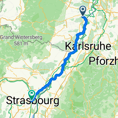 2018-06 Lingenfeld-Strasbourg
- Distance
- 110.8 km
- Ascent
- 81 m
- Descent
- 55 m
- Location
- Lingenfeld, Rhineland-Palatinate, Germany
 Kilianerweg 3, Lingenfeld nach Kilianerweg 3, Lingenfeld
- Distance
- 47.2 km
- Ascent
- 170 m
- Descent
- 226 m
- Location
- Lingenfeld, Rhineland-Palatinate, Germany
 K31 nach K31
- Distance
- 202.6 km
- Ascent
- 2,373 m
- Descent
- 2,371 m
- Location
- Lingenfeld, Rhineland-Palatinate, Germany
 Pfalztour I
- Distance
- 62.5 km
- Ascent
- 204 m
- Descent
- 201 m
- Location
- Lingenfeld, Rhineland-Palatinate, Germany
Open it in the app