

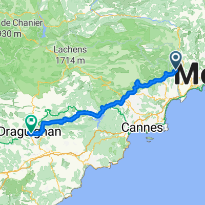
Saint-Jeannet - Moyenne Corniche
A cycling route starting in Gattières, Provence-Alpes-Côte d'Azur Region, France.
Overview
About this route
Down via Via Gattieres and up via Moyenne Corniche
- -:--
- Duration
- 12.6 km
- Distance
- 424 m
- Ascent
- 424 m
- Descent
- ---
- Avg. speed
- ---
- Max. altitude

Route quality
Waytypes & surfaces along the route
Waytypes
Road
4.9 km
(39 %)
Quiet road
2.5 km
(20 %)
Undefined
5.2 km
(41 %)
Surfaces
Paved
10.3 km
(82 %)
Asphalt
10.3 km
(82 %)
Undefined
2.3 km
(18 %)
Continue with Bikemap
Use, edit, or download this cycling route
You would like to ride Saint-Jeannet - Moyenne Corniche or customize it for your own trip? Here is what you can do with this Bikemap route:
Free features
- Save this route as favorite or in collections
- Copy & plan your own version of this route
- Sync your route with Garmin or Wahoo
Premium features
Free trial for 3 days, or one-time payment. More about Bikemap Premium.
- Navigate this route on iOS & Android
- Export a GPX / KML file of this route
- Create your custom printout (try it for free)
- Download this route for offline navigation
Discover more Premium features.
Get Bikemap PremiumFrom our community
Other popular routes starting in Gattières
 2037 Chemin de Provence, Gattières à 206 Avenue Sainte-Marguerite, Nice
- Distance
- 14.5 km
- Ascent
- 70 m
- Descent
- 169 m
- Location
- Gattières, Provence-Alpes-Côte d'Azur Region, France
 Saint-Jeannet - La gaude - Kuitenbijter
- Distance
- 24 km
- Ascent
- 481 m
- Descent
- 481 m
- Location
- Gattières, Provence-Alpes-Côte d'Azur Region, France
 Tour du Baou
- Distance
- 54.2 km
- Ascent
- 1,023 m
- Descent
- 1,023 m
- Location
- Gattières, Provence-Alpes-Côte d'Azur Region, France
 Gattieres-Draguignan
- Distance
- 91.3 km
- Ascent
- 919 m
- Descent
- 997 m
- Location
- Gattières, Provence-Alpes-Côte d'Azur Region, France
 Greolieres
- Distance
- 87.3 km
- Ascent
- 1,279 m
- Descent
- 1,279 m
- Location
- Gattières, Provence-Alpes-Côte d'Azur Region, France
 Baou
Baou- Distance
- 59 km
- Ascent
- 1,540 m
- Descent
- 1,548 m
- Location
- Gattières, Provence-Alpes-Côte d'Azur Region, France
 Saint-Jeannet - Moyenne Corniche
- Distance
- 12.6 km
- Ascent
- 424 m
- Descent
- 424 m
- Location
- Gattières, Provence-Alpes-Côte d'Azur Region, France
 Carros 63k 1240hm
- Distance
- 62.7 km
- Ascent
- 1,100 m
- Descent
- 1,100 m
- Location
- Gattières, Provence-Alpes-Côte d'Azur Region, France
Open it in the app