

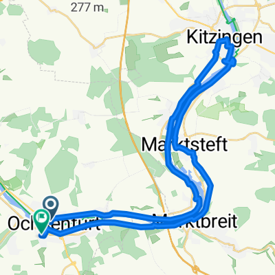
Ochsenfurt-Hüttenheim (Kulinarischer Panoramaausflug)
A cycling route starting in Ochsenfurt, Bavaria, Germany.
Overview
About this route
A beautiful small excursion route in the lovely Franconia. Particularly for cycling visitors to whom one wants to show impressive views and culinary delights of Franconia.
The start and first station is Ochsenfurt: here various gastronomic establishments offer something for everyone, so that one can ride strengthened on the tour. The historian also has something to explore.
In Marktbreit, Franconian hospitality also invites to the table, but for us it is "just" a stopover. A small detour is worthwhile, for those who appreciate small historical villages.
A stop (also an endpoint!) is the Paradiesscheune above Hüttenheim. A hearty snack or coffee and cake should satisfy any hunger.
I choose the cake, enjoy the view (as far as Schweinfurt and the foothills of the Rhön!!!), to enjoy a most delicious dinner in Hüttenheim (Vino Valentino).
The way back follows the same paths and is significantly faster and easier, as it is almost continuously downhill. In this sense, enjoy your meal.
- -:--
- Duration
- 23.8 km
- Distance
- 372 m
- Ascent
- 270 m
- Descent
- ---
- Avg. speed
- 381 m
- Max. altitude
Route quality
Waytypes & surfaces along the route
Waytypes
Track
11.4 km
(48 %)
Quiet road
4.8 km
(20 %)
Surfaces
Paved
18.3 km
(77 %)
Unpaved
3.6 km
(15 %)
Asphalt
11.9 km
(50 %)
Concrete
3.3 km
(14 %)
Continue with Bikemap
Use, edit, or download this cycling route
You would like to ride Ochsenfurt-Hüttenheim (Kulinarischer Panoramaausflug) or customize it for your own trip? Here is what you can do with this Bikemap route:
Free features
- Save this route as favorite or in collections
- Copy & plan your own version of this route
- Sync your route with Garmin or Wahoo
Premium features
Free trial for 3 days, or one-time payment. More about Bikemap Premium.
- Navigate this route on iOS & Android
- Export a GPX / KML file of this route
- Create your custom printout (try it for free)
- Download this route for offline navigation
Discover more Premium features.
Get Bikemap PremiumFrom our community
Other popular routes starting in Ochsenfurt
 Hausrunde III kurz
- Distance
- 16.6 km
- Ascent
- 140 m
- Descent
- 75 m
- Location
- Ochsenfurt, Bavaria, Germany
 B11: Ochsenfurt - Feuchtwangen, 83,1km 526hm
- Distance
- 83.1 km
- Ascent
- 526 m
- Descent
- 265 m
- Location
- Ochsenfurt, Bavaria, Germany
 3. Etappe Würzburg - Göttingen
- Distance
- 397.8 km
- Ascent
- 1,129 m
- Descent
- 975 m
- Location
- Ochsenfurt, Bavaria, Germany
 Main_4
- Distance
- 50.9 km
- Ascent
- 104 m
- Descent
- 114 m
- Location
- Ochsenfurt, Bavaria, Germany
 Ochsenfurt-Veitshöchheim
- Distance
- 60.5 km
- Ascent
- 109 m
- Descent
- 109 m
- Location
- Ochsenfurt, Bavaria, Germany
 B2-10/B12b: Ochsenfurt - Schillingsfürst, 66,5km 610hm
- Distance
- 66.5 km
- Ascent
- 742 m
- Descent
- 431 m
- Location
- Ochsenfurt, Bavaria, Germany
 Aufnahme vom 05.06.2017, 16:55
- Distance
- 32.5 km
- Ascent
- 124 m
- Descent
- 102 m
- Location
- Ochsenfurt, Bavaria, Germany
 Ochsenfurt-Hüttenheim (Kulinarischer Panoramaausflug)
- Distance
- 23.8 km
- Ascent
- 372 m
- Descent
- 270 m
- Location
- Ochsenfurt, Bavaria, Germany
Open it in the app