

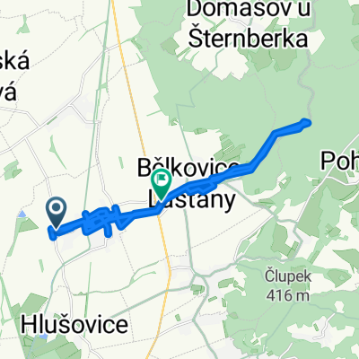
Olomouc - Radíkov - Svatý Kopeček - Olomouc
A cycling route starting in Bohuňovice, Olomoucký kraj, Czechia.
Overview
About this route
Ride from the center of Olomouc along the Trusovický brook to Hlušovice, Týneček, Dolany, Bělkovice, and then along the red trail through the forest following the brook uphill to Pohořany, and from there continuing on the red trail to Radíkov, to the fortification and Sv. Kopeček. From there back to the center of Olomouc via the bike path. A beautiful 43 km with a mix of asphalt and terrain about 70:30.
- -:--
- Duration
- 42.9 km
- Distance
- 528 m
- Ascent
- 531 m
- Descent
- ---
- Avg. speed
- ---
- Max. altitude
Continue with Bikemap
Use, edit, or download this cycling route
You would like to ride Olomouc - Radíkov - Svatý Kopeček - Olomouc or customize it for your own trip? Here is what you can do with this Bikemap route:
Free features
- Save this route as favorite or in collections
- Copy & plan your own version of this route
- Sync your route with Garmin or Wahoo
Premium features
Free trial for 3 days, or one-time payment. More about Bikemap Premium.
- Navigate this route on iOS & Android
- Export a GPX / KML file of this route
- Create your custom printout (try it for free)
- Download this route for offline navigation
Discover more Premium features.
Get Bikemap PremiumFrom our community
Other popular routes starting in Bohuňovice
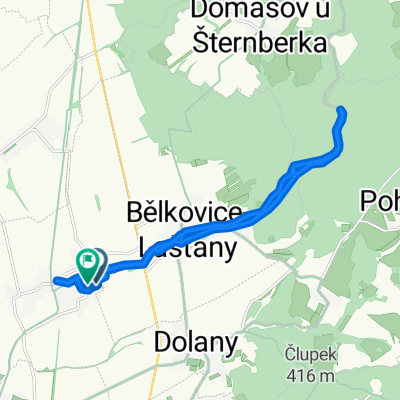
 Výmol do Bělkovice-Lašťany
- Distance
- 31.5 km
- Ascent
- 252 m
- Descent
- 278 m
- Location
- Bohuňovice, Olomoucký kraj, Czechia
 Olomouc - Radíkov - Svatý Kopeček - Olomouc
- Distance
- 42.9 km
- Ascent
- 528 m
- Descent
- 531 m
- Location
- Bohuňovice, Olomoucký kraj, Czechia
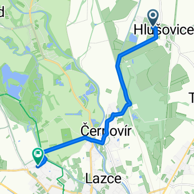
 Loučky, Hlušovice do Silnice bez názvu, Horka nad Moravou
- Distance
- 8 km
- Ascent
- 21 m
- Descent
- 19 m
- Location
- Bohuňovice, Olomoucký kraj, Czechia
 Bohunovice-Napajedla
- Distance
- 70.4 km
- Ascent
- 120 m
- Descent
- 166 m
- Location
- Bohuňovice, Olomoucký kraj, Czechia
 LašťanyGrad
- Distance
- 857.5 km
- Ascent
- 2,664 m
- Descent
- 2,921 m
- Location
- Bohuňovice, Olomoucký kraj, Czechia
 Bělkovice-slovensko
- Distance
- 260.3 km
- Ascent
- 412 m
- Descent
- 553 m
- Location
- Bohuňovice, Olomoucký kraj, Czechia
 Východní do Svatoplukova
- Distance
- 6.5 km
- Ascent
- 19 m
- Descent
- 11 m
- Location
- Bohuňovice, Olomoucký kraj, Czechia
 U Stavu do Bohuňovice
- Distance
- 18.8 km
- Ascent
- 174 m
- Descent
- 223 m
- Location
- Bohuňovice, Olomoucký kraj, Czechia
Open it in the app