

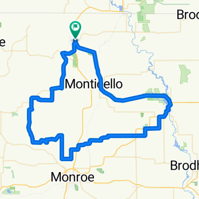
New Glarus to Yellowstone Loop
A cycling route starting in New Glarus, Wisconsin, United States.
Overview
About this route
50 mi loop many up hills and downhills with a lake at the midpoint and a nice cafe for lunch
- -:--
- Duration
- 74 km
- Distance
- 647 m
- Ascent
- 647 m
- Descent
- ---
- Avg. speed
- ---
- Max. altitude
Route quality
Waytypes & surfaces along the route
Waytypes
Quiet road
41.4 km
(56 %)
Road
28.1 km
(38 %)
Surfaces
Paved
48.8 km
(66 %)
Asphalt
40.7 km
(55 %)
Paved (undefined)
8.1 km
(11 %)
Undefined
25.1 km
(34 %)
Continue with Bikemap
Use, edit, or download this cycling route
You would like to ride New Glarus to Yellowstone Loop or customize it for your own trip? Here is what you can do with this Bikemap route:
Free features
- Save this route as favorite or in collections
- Copy & plan your own version of this route
- Sync your route with Garmin or Wahoo
Premium features
Free trial for 3 days, or one-time payment. More about Bikemap Premium.
- Navigate this route on iOS & Android
- Export a GPX / KML file of this route
- Create your custom printout (try it for free)
- Download this route for offline navigation
Discover more Premium features.
Get Bikemap PremiumFrom our community
Other popular routes starting in New Glarus
 401 Railroad St, New Glarus to 10129 Meandering Way, Madison
- Distance
- 43 km
- Ascent
- 527 m
- Descent
- 460 m
- Location
- New Glarus, Wisconsin, United States
 NG West
- Distance
- 44.4 km
- Ascent
- 296 m
- Descent
- 296 m
- Location
- New Glarus, Wisconsin, United States
 Devon's Journey NG to MH
- Distance
- 30 km
- Ascent
- 240 m
- Descent
- 153 m
- Location
- New Glarus, Wisconsin, United States
 New Glarus to Yellowstone Loop
- Distance
- 74 km
- Ascent
- 647 m
- Descent
- 647 m
- Location
- New Glarus, Wisconsin, United States
 418 Railroad St, New Glarus to 418 Railroad St, New Glarus
- Distance
- 31.8 km
- Ascent
- 235 m
- Descent
- 238 m
- Location
- New Glarus, Wisconsin, United States
 New Glarus to home
- Distance
- 44.2 km
- Ascent
- 289 m
- Descent
- 241 m
- Location
- New Glarus, Wisconsin, United States
 New Glarus, Sugar River Trail Return
- Distance
- 88.1 km
- Ascent
- 321 m
- Descent
- 322 m
- Location
- New Glarus, Wisconsin, United States
 Blanchardville
- Distance
- 68.3 km
- Ascent
- 521 m
- Descent
- 518 m
- Location
- New Glarus, Wisconsin, United States
Open it in the app