

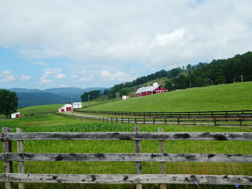
Three-Mountain Ride
A cycling route starting in Marlinton, West Virginia, United States.
Overview
About this route
About 69 miles (110 km). Park at roadside at Frost, WV. At Dunmore, stay right toward Green Bank, WV. Mostly flat/rolling, but one small climb before reaching US 250 near Bartow. Right on US 250 toward Monterey, VA. First and biggest climb up Tamarack Ridge (1080 feet in 3.5 miles) to the WV/VA border. Down the steep hill to Back Creek, then another climb up Lantz Mountain (500 feet in 1.6 miles). Down the hill to Hightown, then up Monterey Mountain (720 feet in 2.1 miles). Down to Monterey, VA. Right on US 220, then right on VA 84. Rolling/flat through Mill Gap, VA. One final climb (420 feet in 1.3 miles) to the WV border, then flat/downhill back to Frost. A beautiful ride! Some truck traffic between Dunmore and Bartow, but otherwise very little traffic. Road surface is good to excellent; a little rough going up Tamarack Ridge.
- -:--
- Duration
- 110.7 km
- Distance
- 1,909 m
- Ascent
- 1,711 m
- Descent
- ---
- Avg. speed
- 1,333 m
- Max. altitude
Route quality
Waytypes & surfaces along the route
Waytypes
Cycleway
34.3 km
(31 %)
Track
6.6 km
(6 %)
Surfaces
Paved
73 km
(66 %)
Unpaved
6.6 km
(6 %)
Paved (undefined)
39.8 km
(36 %)
Asphalt
33.2 km
(30 %)
Continue with Bikemap
Use, edit, or download this cycling route
You would like to ride Three-Mountain Ride or customize it for your own trip? Here is what you can do with this Bikemap route:
Free features
- Save this route as favorite or in collections
- Copy & plan your own version of this route
- Split it into stages to create a multi-day tour
- Sync your route with Garmin or Wahoo
Premium features
Free trial for 3 days, or one-time payment. More about Bikemap Premium.
- Navigate this route on iOS & Android
- Export a GPX / KML file of this route
- Create your custom printout (try it for free)
- Download this route for offline navigation
Discover more Premium features.
Get Bikemap PremiumFrom our community
Other popular routes starting in Marlinton
 Clover Lick - Green Bank
- Distance
- 50.3 km
- Ascent
- 546 m
- Descent
- 546 m
- Location
- Marlinton, West Virginia, United States
 AML (over the ridge)
- Distance
- 92.8 km
- Ascent
- 1,694 m
- Descent
- 1,649 m
- Location
- Marlinton, West Virginia, United States
 Hillsboro-Lobelia Loop
- Distance
- 28.7 km
- Ascent
- 571 m
- Descent
- 571 m
- Location
- Marlinton, West Virginia, United States
 Hillsboro - Droop - Locust Creek Loop
- Distance
- 28.6 km
- Ascent
- 421 m
- Descent
- 421 m
- Location
- Marlinton, West Virginia, United States
 Clover Lick - Observatory Route
- Distance
- 64.9 km
- Ascent
- 552 m
- Descent
- 555 m
- Location
- Marlinton, West Virginia, United States
 Lobelia Loop
- Distance
- 39.3 km
- Ascent
- 690 m
- Descent
- 690 m
- Location
- Marlinton, West Virginia, United States
 Assault on Droop Mountain
- Distance
- 73.7 km
- Ascent
- 1,053 m
- Descent
- 1,053 m
- Location
- Marlinton, West Virginia, United States
 Marlinton Loop
- Distance
- 63.5 km
- Ascent
- 1,209 m
- Descent
- 1,208 m
- Location
- Marlinton, West Virginia, United States
Open it in the app