Grenze Süd - Naturpark- Prag
A cycling route starting in Velká Hleďsebe, Karlovarský kraj, Czechia.
Overview
About this route
South Variant
(cloned from route 2164681)
- -:--
- Duration
- 177.7 km
- Distance
- 921 m
- Ascent
- 1,381 m
- Descent
- ---
- Avg. speed
- ---
- Max. altitude
Route quality
Waytypes & surfaces along the route
Waytypes
Road
23.1 km
(13 %)
Quiet road
12.4 km
(7 %)
Surfaces
Paved
88.8 km
(50 %)
Unpaved
5.3 km
(3 %)
Asphalt
88.8 km
(50 %)
Unpaved (undefined)
5.3 km
(3 %)
Undefined
83.5 km
(47 %)
Continue with Bikemap
Use, edit, or download this cycling route
You would like to ride Grenze Süd - Naturpark- Prag or customize it for your own trip? Here is what you can do with this Bikemap route:
Free features
- Save this route as favorite or in collections
- Copy & plan your own version of this route
- Split it into stages to create a multi-day tour
- Sync your route with Garmin or Wahoo
Premium features
Free trial for 3 days, or one-time payment. More about Bikemap Premium.
- Navigate this route on iOS & Android
- Export a GPX / KML file of this route
- Create your custom printout (try it for free)
- Download this route for offline navigation
Discover more Premium features.
Get Bikemap PremiumFrom our community
Other popular routes starting in Velká Hleďsebe
- Marianske L - Dily
- Distance
- 77.5 km
- Ascent
- 986 m
- Descent
- 941 m
- Location
- Velká Hleďsebe, Karlovarský kraj, Czechia
- Grenze Süd - Naturpark- Prag
- Distance
- 177.7 km
- Ascent
- 921 m
- Descent
- 1,381 m
- Location
- Velká Hleďsebe, Karlovarský kraj, Czechia
- Z Hamrníků přes Kladskou okruhem k Hamelice a do Hamrníků
- Distance
- 43.1 km
- Ascent
- 589 m
- Descent
- 589 m
- Location
- Velká Hleďsebe, Karlovarský kraj, Czechia
- Mähring - Karlsbad - Mähring
- Distance
- 146.4 km
- Ascent
- 1,492 m
- Descent
- 1,491 m
- Location
- Velká Hleďsebe, Karlovarský kraj, Czechia
- Z Hamrníků přes Kladskou okruhem k Hamelice a do Hamrníků
- Distance
- 43.1 km
- Ascent
- 601 m
- Descent
- 601 m
- Location
- Velká Hleďsebe, Karlovarský kraj, Czechia
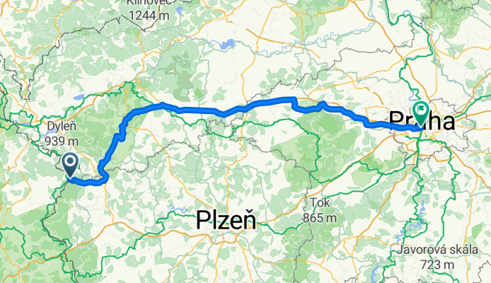
- Marianske L - Plzen 2.etapp
- Distance
- 90.8 km
- Ascent
- 1,174 m
- Descent
- 1,404 m
- Location
- Velká Hleďsebe, Karlovarský kraj, Czechia
- M-L - Plzen
- Distance
- 89.1 km
- Ascent
- 1,233 m
- Descent
- 1,462 m
- Location
- Velká Hleďsebe, Karlovarský kraj, Czechia
- Rundfahrt Mähring - Marianske Lazne (CZ)
- Distance
- 64.1 km
- Ascent
- 916 m
- Descent
- 916 m
- Location
- Velká Hleďsebe, Karlovarský kraj, Czechia
Open it in the app