Loop through Mousehole
A cycling route starting in Camborne, England, United Kingdom.
Overview
About this route
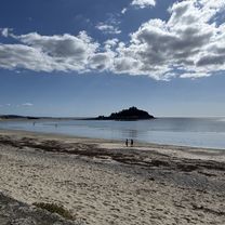
Nice route to North Cliffs down to Mousehole and back. Some tough climbs.
- -:--
- Duration
- 76.5 km
- Distance
- 505 m
- Ascent
- 505 m
- Descent
- ---
- Avg. speed
- ---
- Max. altitude
Route quality
Waytypes & surfaces along the route
Waytypes
Quiet road
32.6 km
(43 %)
Busy road
21.6 km
(28 %)
Surfaces
Paved
48.6 km
(64 %)
Asphalt
47.2 km
(62 %)
Concrete
0.9 km
(1 %)
Continue with Bikemap
Use, edit, or download this cycling route
You would like to ride Loop through Mousehole or customize it for your own trip? Here is what you can do with this Bikemap route:
Free features
- Save this route as favorite or in collections
- Copy & plan your own version of this route
- Sync your route with Garmin or Wahoo
Premium features
Free trial for 3 days, or one-time payment. More about Bikemap Premium.
- Navigate this route on iOS & Android
- Export a GPX / KML file of this route
- Create your custom printout (try it for free)
- Download this route for offline navigation
Discover more Premium features.
Get Bikemap PremiumFrom our community
Other popular routes starting in Camborne
- Loop through Mousehole
- Distance
- 76.5 km
- Ascent
- 505 m
- Descent
- 505 m
- Location
- Camborne, England, United Kingdom
- From Camborne to Truro
- Distance
- 11.4 km
- Ascent
- 112 m
- Descent
- 205 m
- Location
- Camborne, England, United Kingdom
- periple 11 - 6
- Distance
- 156.1 km
- Ascent
- 1,001 m
- Descent
- 1,006 m
- Location
- Camborne, England, United Kingdom
- loop through Gwinear
- Distance
- 33.9 km
- Ascent
- 269 m
- Descent
- 269 m
- Location
- Camborne, England, United Kingdom
- 19-06-13
- Distance
- 70.3 km
- Ascent
- 433 m
- Descent
- 433 m
- Location
- Camborne, England, United Kingdom
- St Keverne loop
- Distance
- 64.3 km
- Ascent
- 0 m
- Descent
- 0 m
- Location
- Camborne, England, United Kingdom
- 20 mile loop
- Distance
- 31.7 km
- Ascent
- 0 m
- Descent
- 0 m
- Location
- Camborne, England, United Kingdom
- 19-06-13
- Distance
- 67.7 km
- Ascent
- 490 m
- Descent
- 490 m
- Location
- Camborne, England, United Kingdom
Open it in the app