

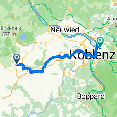
int. Eifellandrundfahrt 2012 - RTF des Radsportclub Eifelland Mayen e.V. - 75 km Strecke
A cycling route starting in Mayen, Rhineland-Palatinate, Germany.
Overview
About this route
<span style="color: #0000ff; text-decoration: underline;"><img alt="" border="0" src="http://www.diwoinfo.de/images/urlpfeil.jpg" /><span style="font-weight:bold; font-size:100%;"> int. Eifellandrundfahrt</span></span> 2012- <span style="color: #0000ff; text-decoration: underline;"><img alt="" border="0" src="http://diwoinfo.de/images/urlpfeil.jpg" /> 75 km</span>
RTF des<br /> <span style="color: #ff0000; text-decoration: underline;"><img alt="" border="0" src="http://www.diwoinfo.de/images/urlpfeil.jpg" /> RSC Eifelland Mayen e.V.</span> Start und Ziel:<br /> Sporthalle<br /> In der Weiersbach<br /> 56727 Mayen<br /> Start: 07:00 - 09:00 Uhr Strecken der RTF <span style="color: #0000ff; text-decoration: underline;"><img alt="" border="0" src="http://www.diwoinfo.de/images/urlpfeil.jpg" /><span style="font-weight:bold; font-size:100%;"> int. Eifellandrundfahrt</span></span> 2013<br /> (z. B. RTF-Nr.: 2303/13 am 16.06.2013)<br /> <span style="color: #0000ff; text-decoration: underline;"><img alt="" border="0" src="http://www.diwo.eu/upfeil.jpg" /> 50 km</span> - <span style="color: #0000ff; text-decoration: underline;"><img alt="" border="0" src="http://www.diwo.eu/upfeil.jpg" /> 75 km</span> - <span style="color: #0000ff; text-decoration: underline;"><img alt="" border="0" src="http://www.diwo.eu/upfeil.jpg" /> 112 km</span> - <span style="color: #0000ff; text-decoration: underline;"><img alt="" border="0" src="http://www.diwo.eu/upfeil.jpg" /> 151 km</span> - <span style="color: #0000ff; text-decoration: underline;"><img alt="" border="0" src="http://www.diwo.eu/upfeil.jpg" /> 210 km</span> <span style="text-decoration: underline;">weitere Touren vom Verein</span><br /> <span style="color: #008000;">Permanente RTF:</span> <span style="color: #008000; text-decoration: underline;">Fröhliche Eifeltour</span><br /> <span style="color: #008000; text-decoration: underline;"><img alt="" border="0" src="http://www.diwo.eu/upfeil.jpg" /> 80 km</span> - RTF-Nr.: 860/13<br /> <span style="color: #008000; text-decoration: underline;">Nette Rhein Nette Tour</span><br /> <span style="color: #008000; text-decoration: underline;"><img alt="" border="0" src="http://www.diwo.eu/upfeil.jpg" /> 76 km</span> - RTF-Nr.: 861/13<br /> <span style="color: #008000; text-decoration: underline;">Opel Sürth Permanente</span><br /> <span style="color: #008000; text-decoration: underline;"><img alt="" border="0" src="http://www.diwo.eu/upfeil.jpg" /> 73 km</span> - RTF-Nr.: 862/13- -:--
- Duration
- 74 km
- Distance
- 773 m
- Ascent
- 773 m
- Descent
- ---
- Avg. speed
- ---
- Max. altitude

Route quality
Waytypes & surfaces along the route
Waytypes
Road
17.8 km
(24 %)
Track
5.9 km
(8 %)
Surfaces
Paved
68.8 km
(93 %)
Unpaved
1.5 km
(2 %)
Asphalt
68.8 km
(93 %)
Unpaved (undefined)
0.7 km
(1 %)
Route highlights
Points of interest along the route
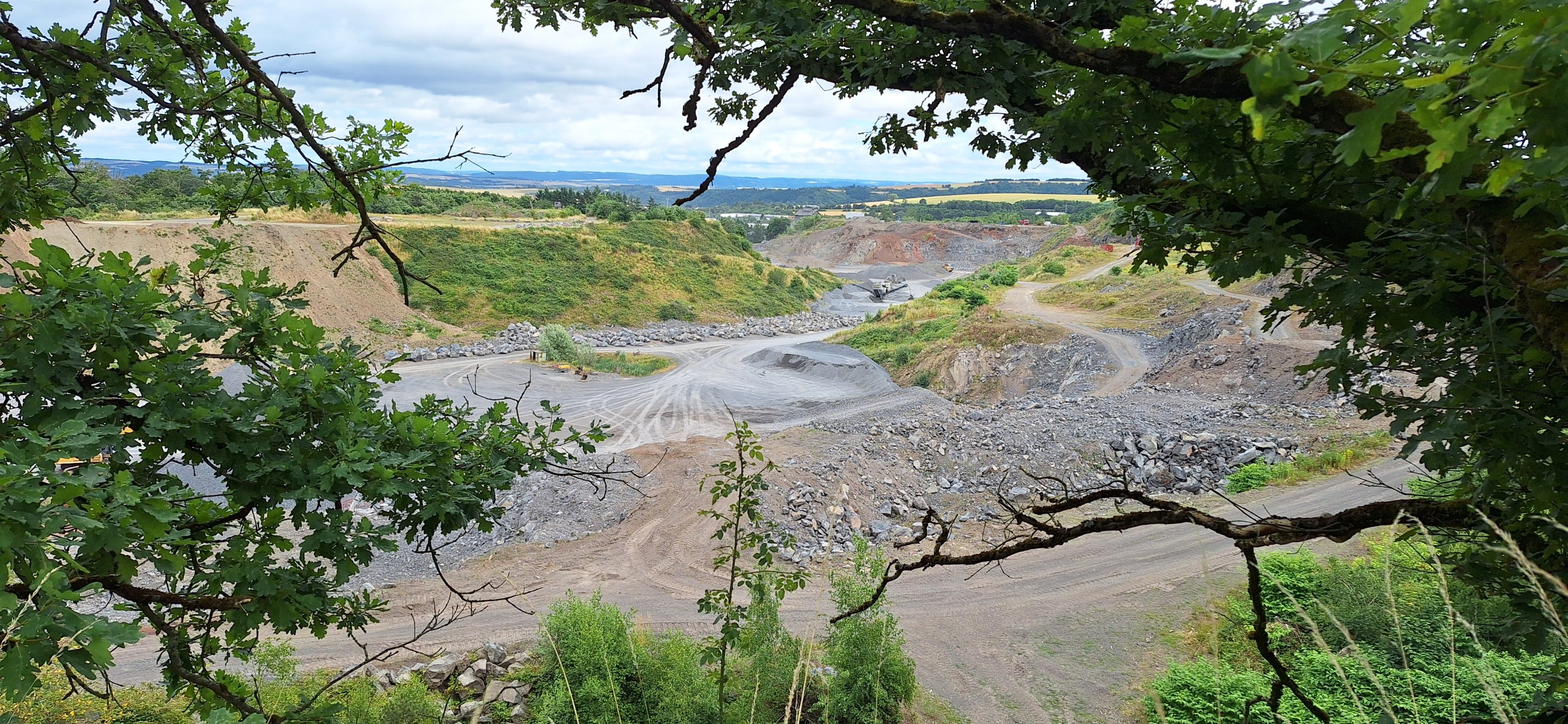
Point of interest after 29.7 km
Kontrolle 1 <b>Roes</b>
Point of interest after 53.8 km
Kontrolle 2 <b>Laubach</b>
Continue with Bikemap
Use, edit, or download this cycling route
You would like to ride int. Eifellandrundfahrt 2012 - RTF des Radsportclub Eifelland Mayen e.V. - 75 km Strecke or customize it for your own trip? Here is what you can do with this Bikemap route:
Free features
- Save this route as favorite or in collections
- Copy & plan your own version of this route
- Sync your route with Garmin or Wahoo
Premium features
Free trial for 3 days, or one-time payment. More about Bikemap Premium.
- Navigate this route on iOS & Android
- Export a GPX / KML file of this route
- Create your custom printout (try it for free)
- Download this route for offline navigation
Discover more Premium features.
Get Bikemap PremiumFrom our community
Other popular routes starting in Mayen
 lange Route
- Distance
- 9.9 km
- Ascent
- 504 m
- Descent
- 552 m
- Location
- Mayen, Rhineland-Palatinate, Germany
 Goethestraße nach Goethestraße
- Distance
- 23.7 km
- Ascent
- 239 m
- Descent
- 302 m
- Location
- Mayen, Rhineland-Palatinate, Germany
 Route mit Steigung und Berg runter
- Distance
- 2.4 km
- Ascent
- 99 m
- Descent
- 205 m
- Location
- Mayen, Rhineland-Palatinate, Germany
 Nächtliche kleine Rundfahrten
- Distance
- 4.6 km
- Ascent
- 183 m
- Descent
- 227 m
- Location
- Mayen, Rhineland-Palatinate, Germany
 Maifeld-Radweg 18km
- Distance
- 44.6 km
- Ascent
- 367 m
- Descent
- 499 m
- Location
- Mayen, Rhineland-Palatinate, Germany
 int. Eifellandrundfahrt 2012 - RTF des Radsportclub Eifelland Mayen e.V. - 75 km Strecke
- Distance
- 74 km
- Ascent
- 773 m
- Descent
- 773 m
- Location
- Mayen, Rhineland-Palatinate, Germany
 In der Weiersbach 3, Mayen nach In der Weiersbach 1, Mayen
- Distance
- 5.7 km
- Ascent
- 273 m
- Descent
- 338 m
- Location
- Mayen, Rhineland-Palatinate, Germany
 int. Eifellandrundfahrt 2012 - RTF des Radsportclub Eifelland Mayen e.V. - 50 km Strecke
- Distance
- 46.2 km
- Ascent
- 608 m
- Descent
- 605 m
- Location
- Mayen, Rhineland-Palatinate, Germany
Open it in the app