

3 Ländertour die Uina-Schlucht hoch
A cycling route starting in Nauders, Tyrol, Austria.
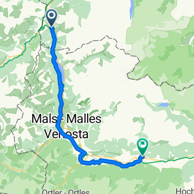
Overview
About this route
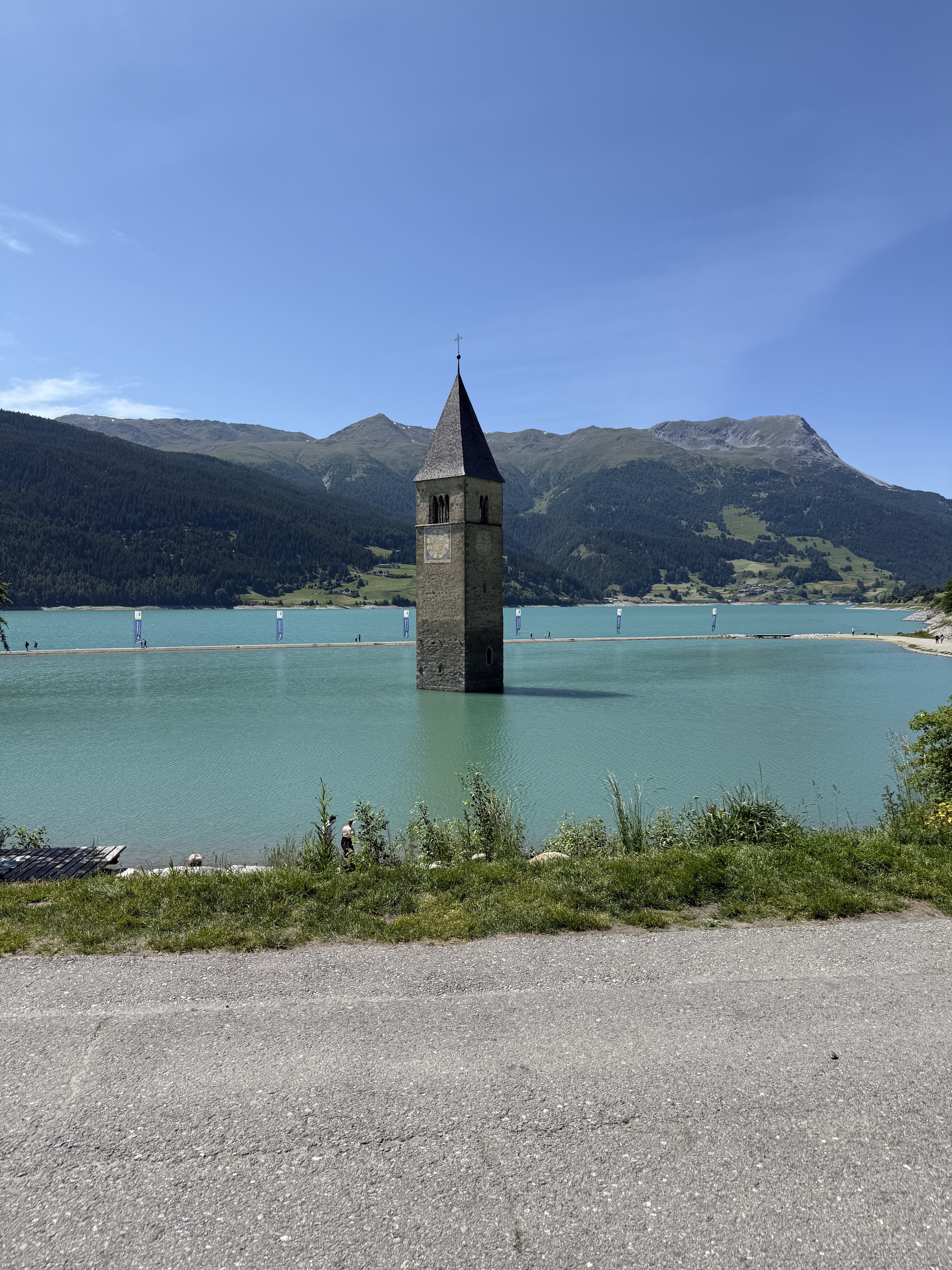
Grandiose, long MTB round with a long pushing section and an endless downhill into Vinschgau. Return via Lake Resia
- -:--
- Duration
- 73.6 km
- Distance
- 1,822 m
- Ascent
- 1,822 m
- Descent
- ---
- Avg. speed
- ---
- Max. altitude
Route highlights
Points of interest along the route

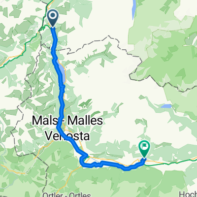
Point of interest after 16.9 km

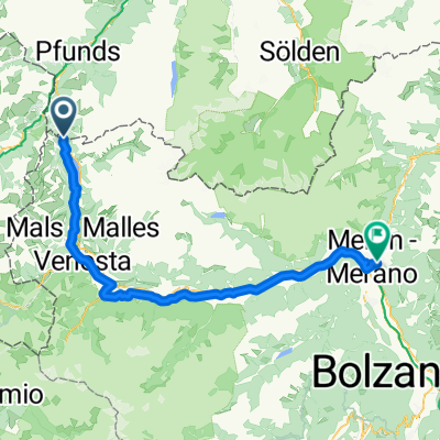
Point of interest after 24.7 km

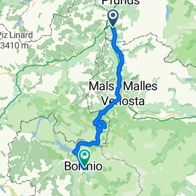
Point of interest after 62.1 km
Continue with Bikemap
Use, edit, or download this cycling route
You would like to ride 3 Ländertour die Uina-Schlucht hoch or customize it for your own trip? Here is what you can do with this Bikemap route:
Free features
- Save this route as favorite or in collections
- Copy & plan your own version of this route
- Sync your route with Garmin or Wahoo
Premium features
Free trial for 3 days, or one-time payment. More about Bikemap Premium.
- Navigate this route on iOS & Android
- Export a GPX / KML file of this route
- Create your custom printout (try it for free)
- Download this route for offline navigation
Discover more Premium features.
Get Bikemap PremiumFrom our community
Other popular routes starting in Nauders
 Favorit-1. Etape_Nauders-Meran_87km
- Distance
- 86.6 km
- Ascent
- 856 m
- Descent
- 1,963 m
- Location
- Nauders, Tyrol, Austria
 Fuhrmannsloch, Nauders nach Reschenstraße, Nauders
- Distance
- 43.6 km
- Ascent
- 613 m
- Descent
- 643 m
- Location
- Nauders, Tyrol, Austria
 Von Nauters bis Schlanders
- Distance
- 54 km
- Ascent
- 788 m
- Descent
- 1,424 m
- Location
- Nauders, Tyrol, Austria
 Via Claudia Augusta 08-2025
- Distance
- 85.5 km
- Ascent
- 792 m
- Descent
- 1,907 m
- Location
- Nauders, Tyrol, Austria
 Von Nauders bis Menaggio
- Distance
- 80.8 km
- Ascent
- 3,585 m
- Descent
- 3,727 m
- Location
- Nauders, Tyrol, Austria
 3 Ländertour die Uina-Schlucht hoch
- Distance
- 73.6 km
- Ascent
- 1,822 m
- Descent
- 1,822 m
- Location
- Nauders, Tyrol, Austria
 ALPSKÉ PRŮSMYKY A JEZERA NA KOLE www.nomad.cz
- Distance
- 421.6 km
- Ascent
- 8,346 m
- Descent
- 8,250 m
- Location
- Nauders, Tyrol, Austria
 Pfunds - Graun
- Distance
- 54 km
- Ascent
- 788 m
- Descent
- 1,424 m
- Location
- Nauders, Tyrol, Austria
Open it in the app