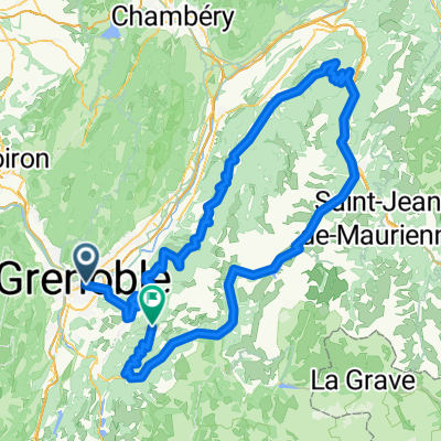
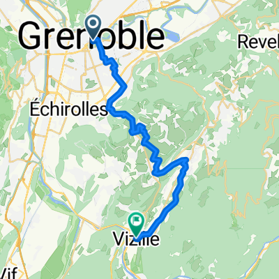
4 seigneurs-Eybens
A cycling route starting in La Tronche, Auvergne-Rh么ne-Alpes, France.
Overview
About this route
Fort 4 seigneurs
- -:--
- Duration
- 24.9 km
- Distance
- 580 m
- Ascent
- 580 m
- Descent
- ---
- Avg. speed
- ---
- Max. altitude
Route quality
Waytypes & surfaces along the route
Waytypes
Road
13.7 km
(55 %)
Busy road
5.6 km
(22 %)
Surfaces
Paved
22.5 km
(91 %)
Asphalt
22.1 km
(89 %)
Paved (undefined)
0.3 km
(1 %)
Continue with Bikemap
Use, edit, or download this cycling route
You would like to ride 4 seigneurs-Eybens or customize it for your own trip? Here is what you can do with this Bikemap route:
Free features
- Save this route as favorite or in collections
- Copy & plan your own version of this route
- Sync your route with Garmin or Wahoo
Premium features
Free trial for 3 days, or one-time payment. More about Bikemap Premium.
- Navigate this route on iOS & Android
- Export a GPX / KML file of this route
- Create your custom printout (try it for free)
- Download this route for offline navigation
Discover more Premium features.
Get Bikemap PremiumFrom our community
Other popular routes starting in La Tronche
- 4 seigneurs-Eybens
- Distance
- 24.9 km
- Ascent
- 580 m
- Descent
- 580 m
- Location
- La Tronche, Auvergne-Rh么ne-Alpes, France
- Boucle Grenoble - Plaine De Reymure
- Distance
- 43.5 km
- Ascent
- 181 m
- Descent
- 176 m
- Location
- La Tronche, Auvergne-Rh么ne-Alpes, France
- Gre-Uriage-Vizille-St georges de Commiers-Vif-Gre
- Distance
- 51.5 km
- Ascent
- 374 m
- Descent
- 374 m
- Location
- La Tronche, Auvergne-Rh么ne-Alpes, France
- Grenoble - Voiron - Col de Porte
- Distance
- 84.3 km
- Ascent
- 2,159 m
- Descent
- 2,158 m
- Location
- La Tronche, Auvergne-Rh么ne-Alpes, France
- Ride sympa
- Distance
- 46.9 km
- Ascent
- 312 m
- Descent
- 310 m
- Location
- La Tronche, Auvergne-Rh么ne-Alpes, France
- Grenoble - La Terrasse - Dom猫ne - Uriage - Pont de Claix - Grenoble
- Distance
- 79.7 km
- Ascent
- 426 m
- Descent
- 426 m
- Location
- La Tronche, Auvergne-Rh么ne-Alpes, France
- MBO 4. Grenoble to Saint-Martin-en-Vercors
- Distance
- 55.3 km
- Ascent
- 1,843 m
- Descent
- 1,299 m
- Location
- La Tronche, Auvergne-Rh么ne-Alpes, France
- Tronche-Col de Porte(classique)
- Distance
- 15 km
- Ascent
- 1,129 m
- Descent
- 30 m
- Location
- La Tronche, Auvergne-Rh么ne-Alpes, France
Open it in the app