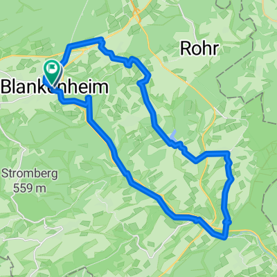

Blankenheim - Malmedy
- 66.9 km
- 771 m
- 933 m
- Blankenheim, North Rhine-Westphalia, Germany
A cycling route starting in Blankenheim, North Rhine-Westphalia, Germany.
Overview
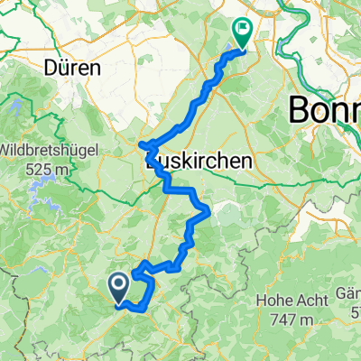
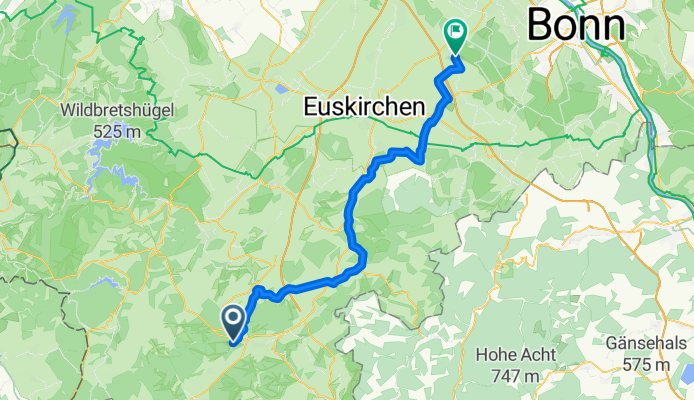
Blankenheim Wald along the railway over Nettersheim (Erftquelle) Bad Münstereifel - Kirspenich towards Swisttal, a very scenic tour, also passing several water castles, not overly strenuous as it is almost all downhill.
(cloned from route 664618)created this 12 years ago
Route quality
Quiet road
17 km
(31 %)
Track
16.4 km
(30 %)
Paved
34.5 km
(63 %)
Unpaved
4.9 km
(9 %)
Asphalt
32.3 km
(59 %)
Loose gravel
3.3 km
(6 %)
Continue with Bikemap
You would like to ride Blankenheim Wald - Nettersheim - Swisttal or customize it for your own trip? Here is what you can do with this Bikemap route:
Free trial for 3 days, or one-time payment. More about Bikemap Premium.
Discover more Premium features.
Get Bikemap PremiumFrom our community
Open it in the app