

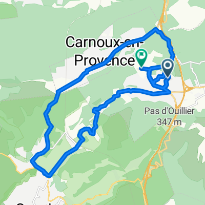
La Bédoule - Plan d'Aups - Espigoulier
A cycling route starting in Roquefort-la-Bédoule, Provence-Alpes-Côte d'Azur Region, France.
Overview
About this route
Tour by the plateau of Plan d'Aups
- -:--
- Duration
- 81.6 km
- Distance
- 951 m
- Ascent
- 955 m
- Descent
- ---
- Avg. speed
- ---
- Max. altitude

Route quality
Waytypes & surfaces along the route
Waytypes
Road
9.8 km
(12 %)
Quiet road
4.9 km
(6 %)
Surfaces
Paved
22 km
(27 %)
Asphalt
22 km
(27 %)
Undefined
59.6 km
(73 %)
Continue with Bikemap
Use, edit, or download this cycling route
You would like to ride La Bédoule - Plan d'Aups - Espigoulier or customize it for your own trip? Here is what you can do with this Bikemap route:
Free features
- Save this route as favorite or in collections
- Copy & plan your own version of this route
- Split it into stages to create a multi-day tour
- Sync your route with Garmin or Wahoo
Premium features
Free trial for 3 days, or one-time payment. More about Bikemap Premium.
- Navigate this route on iOS & Android
- Export a GPX / KML file of this route
- Create your custom printout (try it for free)
- Download this route for offline navigation
Discover more Premium features.
Get Bikemap PremiumFrom our community
Other popular routes starting in Roquefort-la-Bédoule
 Avenue du 8 Mai 1945, Roquefort-la-Bédoule a Rue Ampère, Roquefort-la-Bédoule
- Distance
- 19.7 km
- Ascent
- 527 m
- Descent
- 542 m
- Location
- Roquefort-la-Bédoule, Provence-Alpes-Côte d'Azur Region, France
 La Ciotat - Cassis
- Distance
- 46.7 km
- Ascent
- 912 m
- Descent
- 909 m
- Location
- Roquefort-la-Bédoule, Provence-Alpes-Côte d'Azur Region, France
 NANS - AUPS - ESPI
- Distance
- 81.3 km
- Ascent
- 966 m
- Descent
- 969 m
- Location
- Roquefort-la-Bédoule, Provence-Alpes-Côte d'Azur Region, France
 La Bédoule - Plan d'Aups - Espigoulier
- Distance
- 81.6 km
- Ascent
- 951 m
- Descent
- 955 m
- Location
- Roquefort-la-Bédoule, Provence-Alpes-Côte d'Azur Region, France
 sortie CSC vendredi
- Distance
- 91.1 km
- Ascent
- 1,375 m
- Descent
- 1,346 m
- Location
- Roquefort-la-Bédoule, Provence-Alpes-Côte d'Azur Region, France
 Espigoulier Nans-les-Pins
- Distance
- 78.5 km
- Ascent
- 936 m
- Descent
- 937 m
- Location
- Roquefort-la-Bédoule, Provence-Alpes-Côte d'Azur Region, France
 La bédoule - Chateau Gombert - Aubagne - La Bédoule
- Distance
- 59.5 km
- Ascent
- 744 m
- Descent
- 741 m
- Location
- Roquefort-la-Bédoule, Provence-Alpes-Côte d'Azur Region, France
 La Bédoule - Route des Crêtes
- Distance
- 30.5 km
- Ascent
- 694 m
- Descent
- 695 m
- Location
- Roquefort-la-Bédoule, Provence-Alpes-Côte d'Azur Region, France
Open it in the app