Saint- Jean- Chrysostome / covey hill
- 57.7 km
- 531 m
- 533 m
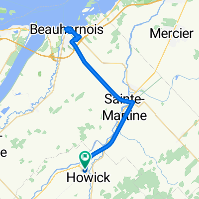
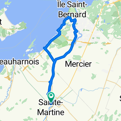
- Sainte-Martine, Quebec, Canada
· P: Marché d'alimentation METRO de St-Chrysostome
· D: Rg St-Charles (4K+) · TD: Rte 202, G : Montée Stevenson (10K+) · D: Sommet Ch. Covey Hill · TD: 20K+ jusqu’à Montée Tremblay (Rte 209) à D. · TD: Franklin (25K+) · D: Rte. 202, D: Mtée Covey Hill · G: Mtée Brooks, D: Rte 202 · G: Rg. Lemieux, D: Mtée Benoit (35K) · G: Rte 202 Havelock (40K) · D: Rte Havelock, D: Ch. Covey Hill · D: Descente Stevenson, D: Rte 202, · G: Mtée Benoit, D: Rg. Lemieux · G: Rg Riv.Noir S. D: Rg Riv.Noir N. · D: Rg Riv.Noir S. D:Rg Duncan · D: Rue Notre Dame vers METRO. Road
20.9 km32 %Quiet road
20.9 km32 %Undefined
23.5 km36 %Paved
13 km(20 %)Asphalt
8.5 km13 %Paved (undefined)
4.6 km7 %Undefined
52.2 km80 %Free trial for 3 days, or one-time payment. More about Bikemap Premium.
Discover more Premium features.
Get Bikemap PremiumOpen it in the app