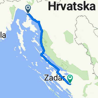
- 210 km
- 2,469 m
- 2,181 m
- Kraljevica, Primorje-Gorski Kotar County, Croatia
KRK - Čabar - DOM
A cycling route starting in Kraljevica, Primorje-Gorski Kotar County, Croatia.
Overview
About this route
KRK - HOME
- -:--
- Duration
- 210 km
- Distance
- 2,469 m
- Ascent
- 2,181 m
- Descent
- ---
- Avg. speed
- ---
- Max. altitude
created this 12 years ago
Route quality
Waytypes & surfaces along the route
Waytypes
Road
48.3 km
(23 %)
Quiet road
18.9 km
(9 %)
Surfaces
Paved
155.4 km
(74 %)
Asphalt
142.8 km
(68 %)
Paved (undefined)
12.6 km
(6 %)
Undefined
54.6 km
(26 %)
Route highlights
Points of interest along the route
Point of interest after 0 km
KAMP KOVAČINE
Point of interest after 28.9 km
Buffet "Carov Most" več informacij » Mrzla Vodica, 46, Lokve, Hrvatska 099 404 5444
Point of interest after 90.9 km
KAMP ANKARAN
Point of interest after 113.3 km
KAMP IN DOBRA GOSTILNA mp Lazar Edi Lazar s.p. več informacij » TRNOVO OB SOČI 1 B, Kobarid, Slovenija (05) 388 84 60
Point of interest after 113.3 km
KAMP BOVEC
Point of interest after 113.3 km
CAMP NATURA
Continue with Bikemap
Use, edit, or download this cycling route
You would like to ride KRK - Čabar - DOM or customize it for your own trip? Here is what you can do with this Bikemap route:
Free features
- Save this route as favorite or in collections
- Copy & plan your own version of this route
- Split it into stages to create a multi-day tour
- Sync your route with Garmin or Wahoo
Premium features
Free trial for 3 days, or one-time payment. More about Bikemap Premium.
- Navigate this route on iOS & Android
- Export a GPX / KML file of this route
- Create your custom printout (try it for free)
- Download this route for offline navigation
Discover more Premium features.
Get Bikemap PremiumFrom our community
Other popular routes starting in Kraljevica
- KRK - Čabar - DOM
- Ulica Marijana Jurkovića to Varos
- 39.9 km
- 720 m
- 776 m
- Kraljevica, Primorje-Gorski Kotar County, Croatia
- Kraljevica to Benkovac
- 201.5 km
- 1,189 m
- 1,097 m
- Kraljevica, Primorje-Gorski Kotar County, Croatia
- krk crikvenica
- 13.1 km
- 184 m
- 271 m
- Kraljevica, Primorje-Gorski Kotar County, Croatia
- Bakarac - Križišće - planina iznad - Drivenik - Bakarac
- 26.8 km
- 872 m
- 871 m
- Kraljevica, Primorje-Gorski Kotar County, Croatia
- Rijeka Illirska Bistrica
- 63.6 km
- 1,397 m
- 988 m
- Kraljevica, Primorje-Gorski Kotar County, Croatia
- Šetalište Vladimira Nazora 14C, Kraljevica to Golubići, Pinezići
- 33.7 km
- 491 m
- 427 m
- Kraljevica, Primorje-Gorski Kotar County, Croatia
- 7H9R+3H nach Centar 92D
- 141.3 km
- 3,054 m
- 3,191 m
- Kraljevica, Primorje-Gorski Kotar County, Croatia
Open it in the app


