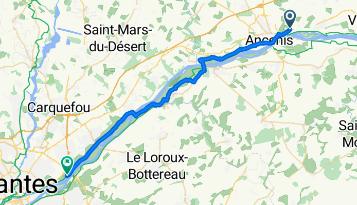
Loire 2013, 4. Tag

A cycling route starting in Ancenis, Pays de la Loire Region, France.
OverviewAbout this route

asdf

-:--
Duration
35 km
Distance
84 m
Ascent
105 m
Descent
---
Avg. speed
---
Max. altitude
majannecreated this 12 years ago
Route qualityWaytypes & surfaces along the route
Waytypes
  • Quiet road

    12.3 km35 %
  • Track

    8.4 km24 %
  • Road

    3.2 km9 %
Surfaces

Paved

29.1 km(83 %)

Unpaved

3.5 km(10 %)
  • Asphalt

    28.4 km81 %
  • Gravel

    3.5 km10 %
  • Concrete

    0.7 km2 %
Continue with BikemapUse, edit, or download this cycling route
You would like to ride Loire 2013, 4. Tag or customize it for your own trip? Here is what you can do with this Bikemap route:
Free features
Premium features

Free trial for 3 days, or one-time payment. More about Bikemap Premium.

  • Navigate this route on iOS & Android
  • Export a GPX / KML file of this route
  • Create your custom printout (try it for free)
  • Download this route for offline navigation

Discover more Premium features.

Get Bikemap Premium
From our communityOther popular routes starting in Ancenis

Open it in the app