

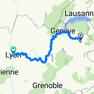
Magland, Cluses, Grand Bornand via Romme and Colombier & back
A cycling route starting in Magland, Auvergne-Rhône-Alpes, France.
Overview
About this route
Warm up from magaland to Cluses then, Romme, Le Reposoir, Colombier, Grand Bornand & back
- -:--
- Duration
- 84.7 km
- Distance
- 2,390 m
- Ascent
- 2,389 m
- Descent
- ---
- Avg. speed
- ---
- Max. altitude
Continue with Bikemap
Use, edit, or download this cycling route
You would like to ride Magland, Cluses, Grand Bornand via Romme and Colombier & back or customize it for your own trip? Here is what you can do with this Bikemap route:
Free features
- Save this route as favorite or in collections
- Copy & plan your own version of this route
- Split it into stages to create a multi-day tour
- Sync your route with Garmin or Wahoo
Premium features
Free trial for 3 days, or one-time payment. More about Bikemap Premium.
- Navigate this route on iOS & Android
- Export a GPX / KML file of this route
- Create your custom printout (try it for free)
- Download this route for offline navigation
Discover more Premium features.
Get Bikemap PremiumFrom our community
Other popular routes starting in Magland
 Les Carroz - Nyon
- Distance
- 75.5 km
- Ascent
- 211 m
- Descent
- 952 m
- Location
- Magland, Auvergne-Rhône-Alpes, France
 Magland-Ayse
- Distance
- 43.4 km
- Ascent
- 156 m
- Descent
- 157 m
- Location
- Magland, Auvergne-Rhône-Alpes, France
 Magland Chamonix
- Distance
- 40.6 km
- Ascent
- 769 m
- Descent
- 238 m
- Location
- Magland, Auvergne-Rhône-Alpes, France
 mimuh
mimuh- Distance
- 195.1 km
- Ascent
- 3,992 m
- Descent
- 5,062 m
- Location
- Magland, Auvergne-Rhône-Alpes, France
 De Rue nationale à Hôtel de Ville L. Pradel
- Distance
- 272.2 km
- Ascent
- 1,759 m
- Descent
- 2,086 m
- Location
- Magland, Auvergne-Rhône-Alpes, France
 Tour du mont Fleury 2 - Aout 2012
- Distance
- 127.9 km
- Ascent
- 2,975 m
- Descent
- 2,975 m
- Location
- Magland, Auvergne-Rhône-Alpes, France
 De Route de Flaine 47, Arâches-la-Frasse à Route de Flaine 47, Arâches-la-Frasse
- Distance
- 5.2 km
- Ascent
- 255 m
- Descent
- 255 m
- Location
- Magland, Auvergne-Rhône-Alpes, France
 Petit tour pour voir où en est la piste cyclable... route nationale jusqu’au 20 septembre !
- Distance
- 3.8 km
- Ascent
- 20 m
- Descent
- 20 m
- Location
- Magland, Auvergne-Rhône-Alpes, France
Open it in the app