Deutschland rundum
- 350.7 km
- 372 m
- 180 m
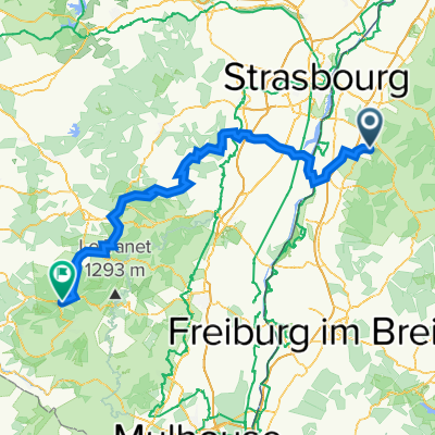
- Ortenberg, Baden-Wurttemberg, Germany
A cycling route starting in Ortenberg, Baden-Wurttemberg, Germany.
Overview
The route is for a scooter tour and goes through Alsace
Route quality
Road
18.8 km
(12 %)
Quiet road
9.4 km
(6 %)
Paved
108 km
(69 %)
Asphalt
108 km
(69 %)
Undefined
48.5 km
(31 %)
Route highlights
Rathaus Zusweier
Continue with Bikemap
You would like to ride Route 1 Elsaßtour (Roller) or customize it for your own trip? Here is what you can do with this Bikemap route:
Free trial for 3 days, or one-time payment. More about Bikemap Premium.
Discover more Premium features.
Get Bikemap PremiumFrom our community
Open it in the app