

Kroatien - Kvarner Bucht- Ucka
A cycling route starting in Opatija, Primorje-Gorski Kotar County, Croatia.
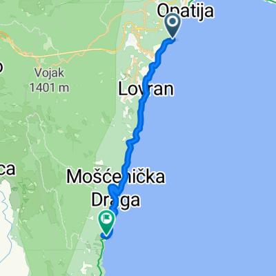
Overview
About this route
Very hilly route with a beautiful view of the Kvarner Bay.
- -:--
- Duration
- 62.2 km
- Distance
- 1,782 m
- Ascent
- 1,777 m
- Descent
- ---
- Avg. speed
- 965 m
- Max. altitude

Route quality
Waytypes & surfaces along the route
Waytypes
Quiet road
3.1 km
(5 %)
Access road
0.6 km
(1 %)
Surfaces
Paved
59.1 km
(95 %)
Asphalt
59.1 km
(95 %)
Undefined
3.1 km
(5 %)
Continue with Bikemap
Use, edit, or download this cycling route
You would like to ride Kroatien - Kvarner Bucht- Ucka or customize it for your own trip? Here is what you can do with this Bikemap route:
Free features
- Save this route as favorite or in collections
- Copy & plan your own version of this route
- Sync your route with Garmin or Wahoo
Premium features
Free trial for 3 days, or one-time payment. More about Bikemap Premium.
- Navigate this route on iOS & Android
- Export a GPX / KML file of this route
- Create your custom printout (try it for free)
- Download this route for offline navigation
Discover more Premium features.
Get Bikemap PremiumFrom our community
Other popular routes starting in Opatija
 Učka bike 1
- Distance
- 14.2 km
- Ascent
- 360 m
- Descent
- 359 m
- Location
- Opatija, Primorje-Gorski Kotar County, Croatia
 opatija Stara Sušica
- Distance
- 84.5 km
- Ascent
- 1,373 m
- Descent
- 709 m
- Location
- Opatija, Primorje-Gorski Kotar County, Croatia
 Kroatien - Kvarner Bucht- Ucka
- Distance
- 62.2 km
- Ascent
- 1,782 m
- Descent
- 1,777 m
- Location
- Opatija, Primorje-Gorski Kotar County, Croatia
 Snehová cesta vo Opatija
- Distance
- 2.1 km
- Ascent
- 8 m
- Descent
- 76 m
- Location
- Opatija, Primorje-Gorski Kotar County, Croatia
 08. LK Brdo-LK Lanišće-LK Brdo
- Distance
- 20.1 km
- Ascent
- 450 m
- Descent
- 450 m
- Location
- Opatija, Primorje-Gorski Kotar County, Croatia
 Istrien Ost West
- Distance
- 86.4 km
- Ascent
- 1,526 m
- Descent
- 1,471 m
- Location
- Opatija, Primorje-Gorski Kotar County, Croatia
 Opatija-Učka-Lupoglav-Matulji-Opatija
- Distance
- 99.3 km
- Ascent
- 2,294 m
- Descent
- 2,239 m
- Location
- Opatija, Primorje-Gorski Kotar County, Croatia
 Ulica Antona Raspora nach D66
- Distance
- 17.5 km
- Ascent
- 169 m
- Descent
- 233 m
- Location
- Opatija, Primorje-Gorski Kotar County, Croatia
Open it in the app