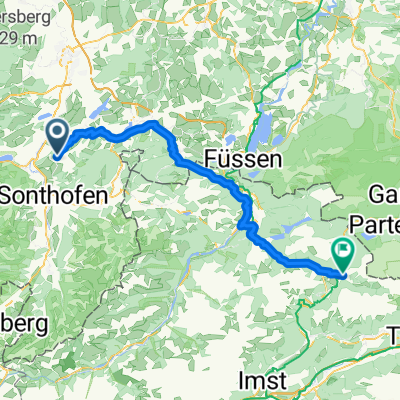
Feierabendrunde (Nebenstraßen)
A cycling route starting in Rettenberg, Bavaria, Germany.
Overview
About this route
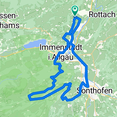
Niedersonthofener See, Öschle See, Rottachsee, Ortwanger See
- -:--
- Duration
- 75.6 km
- Distance
- 584 m
- Ascent
- 584 m
- Descent
- ---
- Avg. speed
- ---
- Avg. speed
Route quality
Waytypes & surfaces along the route
Waytypes
Road
34.6 km
(46 %)
Quiet road
30.4 km
(40 %)
Surfaces
Paved
58 km
(77 %)
Unpaved
0.3 km
(<1 %)
Asphalt
58 km
(77 %)
Gravel
0.2 km
(<1 %)
Continue with Bikemap
Use, edit, or download this cycling route
You would like to ride Feierabendrunde (Nebenstraßen) or customize it for your own trip? Here is what you can do with this Bikemap route:
Free features
- Save this route as favorite or in collections
- Copy & plan your own version of this route
- Sync your route with Garmin or Wahoo
Premium features
Free trial for 3 days, or one-time payment. More about Bikemap Premium.
- Navigate this route on iOS & Android
- Export a GPX / KML file of this route
- Create your custom printout (try it for free)
- Download this route for offline navigation
Discover more Premium features.
Get Bikemap PremiumFrom our community
Other popular routes starting in Rettenberg
- Radstrecke Heuberg, Martinszell, Oberdorf
- Distance
- 4.3 km
- Ascent
- 85 m
- Descent
- 34 m
- Location
- Rettenberg, Bavaria, Germany
- Königsträsschen - Schnitzleralpe/Wertacher Hörnle
- Distance
- 35.2 km
- Ascent
- 806 m
- Descent
- 806 m
- Location
- Rettenberg, Bavaria, Germany
- 2013-14 Altmühltal - Ammersee - Allgäu Eckarts - Hergatz
- Distance
- 59.5 km
- Ascent
- 364 m
- Descent
- 534 m
- Location
- Rettenberg, Bavaria, Germany
- Feierabendrunde (Nebenstraßen)
- Distance
- 75.6 km
- Ascent
- 584 m
- Descent
- 584 m
- Location
- Rettenberg, Bavaria, Germany
- Bodensee-Runde über Rohrmoos/Sibratsgfäll
- Distance
- 149.2 km
- Ascent
- 1,344 m
- Descent
- 1,344 m
- Location
- Rettenberg, Bavaria, Germany
- Grüntenhütte und rund Spieser
- Distance
- 49.2 km
- Ascent
- 1,891 m
- Descent
- 1,891 m
- Location
- Rettenberg, Bavaria, Germany
- 7.7.2020
- Distance
- 37.4 km
- Ascent
- 644 m
- Descent
- 660 m
- Location
- Rettenberg, Bavaria, Germany
- Gunzesried
- Distance
- 44 km
- Ascent
- 411 m
- Descent
- 402 m
- Location
- Rettenberg, Bavaria, Germany
Open it in the app