

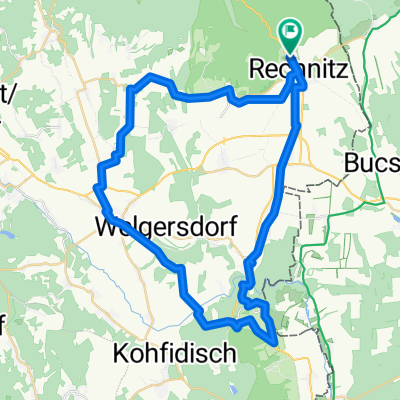
Hegyi edzőkör
A cycling route starting in Rechnitz, Burgenland, Austria.
Overview
About this route
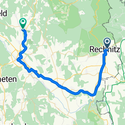
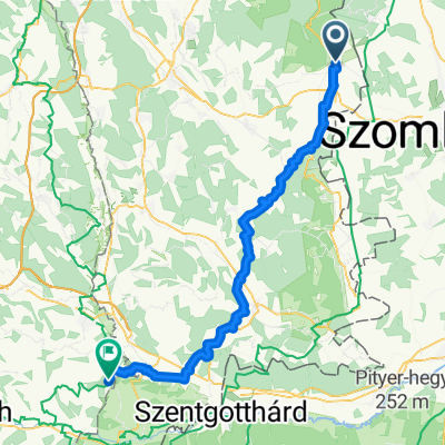
After a steep climb on the Austrian side of the Kőszeg mountain, followed by a fast descent, there is a longer, relatively flat section where we can climb again through Kőszeg. Unfortunately, this section has much worse road quality. After another winding descent, we cross the border at Bozsok via Velem and complete our loop.
Intensive training on varied terrain.
- -:--
- Duration
- 50.1 km
- Distance
- 834 m
- Ascent
- 834 m
- Descent
- ---
- Avg. speed
- ---
- Max. altitude

Route quality
Waytypes & surfaces along the route
Waytypes
Quiet road
11 km
(22 %)
Track
4.5 km
(9 %)
Surfaces
Paved
28.6 km
(57 %)
Unpaved
3.5 km
(7 %)
Asphalt
23.1 km
(46 %)
Paved (undefined)
5.5 km
(11 %)
Continue with Bikemap
Use, edit, or download this cycling route
You would like to ride Hegyi edzőkör or customize it for your own trip? Here is what you can do with this Bikemap route:
Free features
- Save this route as favorite or in collections
- Copy & plan your own version of this route
- Sync your route with Garmin or Wahoo
Premium features
Free trial for 3 days, or one-time payment. More about Bikemap Premium.
- Navigate this route on iOS & Android
- Export a GPX / KML file of this route
- Create your custom printout (try it for free)
- Download this route for offline navigation
Discover more Premium features.
Get Bikemap PremiumFrom our community
Other popular routes starting in Rechnitz
 Naturpark Trail Runde
- Distance
- 26.7 km
- Ascent
- 769 m
- Descent
- 766 m
- Location
- Rechnitz, Burgenland, Austria
 Hegyi edzőkör
- Distance
- 50.1 km
- Ascent
- 834 m
- Descent
- 834 m
- Location
- Rechnitz, Burgenland, Austria
 Bahntrassen-Radweg
- Distance
- 41.3 km
- Ascent
- 269 m
- Descent
- 211 m
- Location
- Rechnitz, Burgenland, Austria
 Sommertour 2025 Tag 3
- Distance
- 63.9 km
- Ascent
- 692 m
- Descent
- 702 m
- Location
- Rechnitz, Burgenland, Austria
 Faludigasse 26–28, Rechnitz nach Faludigasse 26–28, Rechnitz
- Distance
- 18.3 km
- Ascent
- 657 m
- Descent
- 657 m
- Location
- Rechnitz, Burgenland, Austria
 56, Rechnitz nach Hauptplatz, Stinatz
- Distance
- 34.5 km
- Ascent
- 492 m
- Descent
- 499 m
- Location
- Rechnitz, Burgenland, Austria
 Rechnitz Eisenberg Großpetersdorf Rechnitz
- Distance
- 51.6 km
- Ascent
- 720 m
- Descent
- 683 m
- Location
- Rechnitz, Burgenland, Austria
 Lange Ausfahrt durch Rechnitz
- Distance
- 62.9 km
- Ascent
- 364 m
- Descent
- 365 m
- Location
- Rechnitz, Burgenland, Austria
Open it in the app