

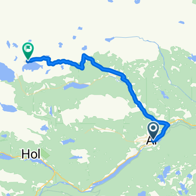
Ål to Golfjellet
A cycling route starting in Ål, Buskerud, Norway.
Overview
About this route
This 40 km route takes us from Ål to the start of the winding RV51.
- -:--
- Duration
- 39.7 km
- Distance
- 1,308 m
- Ascent
- 948 m
- Descent
- ---
- Avg. speed
- ---
- Max. altitude

Continue with Bikemap
Use, edit, or download this cycling route
You would like to ride Ål to Golfjellet or customize it for your own trip? Here is what you can do with this Bikemap route:
Free features
- Save this route as favorite or in collections
- Copy & plan your own version of this route
- Sync your route with Garmin or Wahoo
Premium features
Free trial for 3 days, or one-time payment. More about Bikemap Premium.
- Navigate this route on iOS & Android
- Export a GPX / KML file of this route
- Create your custom printout (try it for free)
- Download this route for offline navigation
Discover more Premium features.
Get Bikemap PremiumFrom our community
Other popular routes starting in Ål
 Ål to Bergsjøstølen
- Distance
- 28 km
- Ascent
- 913 m
- Descent
- 279 m
- Location
- Ål, Buskerud, Norway
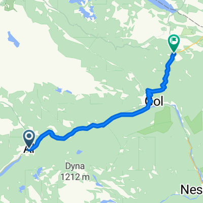
 Ål to Gol
- Distance
- 27.2 km
- Ascent
- 576 m
- Descent
- 781 m
- Location
- Ål, Buskerud, Norway
 Ål-Garnås-Gol-Ål
- Distance
- 67.7 km
- Ascent
- 733 m
- Descent
- 740 m
- Location
- Ål, Buskerud, Norway
 Haddingvegen 18, Ål to Grovvegen 2, Gol
- Distance
- 18.7 km
- Ascent
- 290 m
- Descent
- 448 m
- Location
- Ål, Buskerud, Norway
 Ål - Geilo
- Distance
- 53.2 km
- Ascent
- 1,236 m
- Descent
- 450 m
- Location
- Ål, Buskerud, Norway
 Ål - Djups 50 km
- Distance
- 49.4 km
- Ascent
- 0 m
- Descent
- 0 m
- Location
- Ål, Buskerud, Norway
 Nordbygdvegen 124–188, Ål to Nygardsvegen 200, Hovet
- Distance
- 62.2 km
- Ascent
- 1,787 m
- Descent
- 1,526 m
- Location
- Ål, Buskerud, Norway
 Ål to Golfjellet
- Distance
- 39.7 km
- Ascent
- 1,308 m
- Descent
- 948 m
- Location
- Ål, Buskerud, Norway
Open it in the app