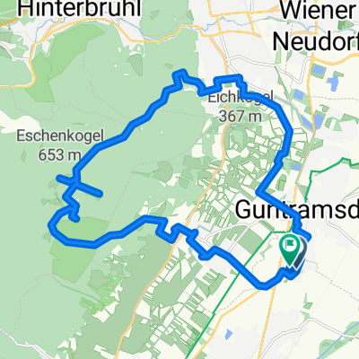
thallern_hafnerberg_brand_klausen_kalten_pdorf_thallern
A cycling route starting in Guntramsdorf, Lower Austria, Austria.
Overview
About this route
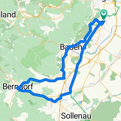
interessante 100km thallern wienerwald thallern
- -:--
- Duration
- 101.3 km
- Distance
- 1,240 m
- Ascent
- 1,208 m
- Descent
- ---
- Avg. speed
- ---
- Max. altitude
Route quality
Waytypes & surfaces along the route
Waytypes
Road
18.2 km
(18 %)
Cycleway
5.1 km
(5 %)
Surfaces
Paved
72.9 km
(72 %)
Unpaved
3 km
(3 %)
Asphalt
72.9 km
(72 %)
Ground
2 km
(2 %)
Continue with Bikemap
Use, edit, or download this cycling route
You would like to ride thallern_hafnerberg_brand_klausen_kalten_pdorf_thallern or customize it for your own trip? Here is what you can do with this Bikemap route:
Free features
- Save this route as favorite or in collections
- Copy & plan your own version of this route
- Split it into stages to create a multi-day tour
- Sync your route with Garmin or Wahoo
Premium features
Free trial for 3 days, or one-time payment. More about Bikemap Premium.
- Navigate this route on iOS & Android
- Export a GPX / KML file of this route
- Create your custom printout (try it for free)
- Download this route for offline navigation
Discover more Premium features.
Get Bikemap PremiumFrom our community
Other popular routes starting in Guntramsdorf
22.08.2018- Distance
- 39.8 km
- Ascent
- 505 m
- Descent
- 505 m
- Location
- Guntramsdorf, Lower Austria, Austria
Runde um den Anninger- Distance
- 42.3 km
- Ascent
- 256 m
- Descent
- 256 m
- Location
- Guntramsdorf, Lower Austria, Austria
Weingartenradweg Thermenradweg- Distance
- 34.5 km
- Ascent
- 162 m
- Descent
- 159 m
- Location
- Guntramsdorf, Lower Austria, Austria
Gtdf-Pfaffstätten-Gaaden-Mödling-Gtdf- Distance
- 28.9 km
- Ascent
- 253 m
- Descent
- 253 m
- Location
- Guntramsdorf, Lower Austria, Austria
guntramsdorf schwechat über brunn- Distance
- 50.6 km
- Ascent
- 96 m
- Descent
- 97 m
- Location
- Guntramsdorf, Lower Austria, Austria
Guntramsdorf Husarentempel Waldabfahrt Goldene Stiege- Distance
- 20.3 km
- Ascent
- 452 m
- Descent
- 451 m
- Location
- Guntramsdorf, Lower Austria, Austria
kurze Runde um den Anninger- Distance
- 34.3 km
- Ascent
- 234 m
- Descent
- 234 m
- Location
- Guntramsdorf, Lower Austria, Austria
Neufeld an der Leitha- Distance
- 80.3 km
- Ascent
- 298 m
- Descent
- 299 m
- Location
- Guntramsdorf, Lower Austria, Austria
Open it in the app

