

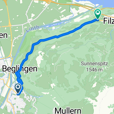
Inline: Mollis - Ennenda
A cycling route starting in Mollis, Canton of Glarus, Switzerland.
Overview
About this route
Mollis Allmeind - Flugplatz - Netstal - Buchholz - Glarus - Ennenda - Ennetbühls - Geska - Netstal - Flugplatz Mollis Allmeind
- -:--
- Duration
- 14.5 km
- Distance
- 57 m
- Ascent
- 55 m
- Descent
- ---
- Avg. speed
- ---
- Max. altitude
Route quality
Waytypes & surfaces along the route
Waytypes
Access road
4.2 km
(29 %)
Quiet road
4.1 km
(28 %)
Surfaces
Paved
12.9 km
(89 %)
Asphalt
12.9 km
(89 %)
Undefined
1.6 km
(11 %)
Continue with Bikemap
Use, edit, or download this cycling route
You would like to ride Inline: Mollis - Ennenda or customize it for your own trip? Here is what you can do with this Bikemap route:
Free features
- Save this route as favorite or in collections
- Copy & plan your own version of this route
- Sync your route with Garmin or Wahoo
Premium features
Free trial for 3 days, or one-time payment. More about Bikemap Premium.
- Navigate this route on iOS & Android
- Export a GPX / KML file of this route
- Create your custom printout (try it for free)
- Download this route for offline navigation
Discover more Premium features.
Get Bikemap PremiumFrom our community
Other popular routes starting in Mollis
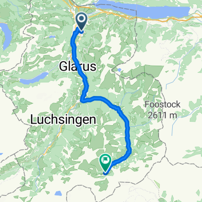
 Klöntal - Längenegg - Obersee
- Distance
- 41 km
- Ascent
- 1,598 m
- Descent
- 1,598 m
- Location
- Mollis, Canton of Glarus, Switzerland
 20/1. Etappe: Mollis - Meiringen, Klausen + Susten
- Distance
- 143.8 km
- Ascent
- 3,290 m
- Descent
- 3,139 m
- Location
- Mollis, Canton of Glarus, Switzerland
 Kernzerberg
- Distance
- 6.1 km
- Ascent
- 354 m
- Descent
- 42 m
- Location
- Mollis, Canton of Glarus, Switzerland
 elm, ab mollis?? nach Äcg??
- Distance
- 33.9 km
- Ascent
- 840 m
- Descent
- 0 m
- Location
- Mollis, Canton of Glarus, Switzerland
 Netstalerstrasse, Mollis nach Ziegelbrückstrasse, Ziegelbrücke
- Distance
- 7.5 km
- Ascent
- 4 m
- Descent
- 27 m
- Location
- Mollis, Canton of Glarus, Switzerland
 Näfels-Uetikon v. Siebnen - Rinderweidhorn - Meinrad - Horgen
- Distance
- 64.6 km
- Ascent
- 1,020 m
- Descent
- 1,016 m
- Location
- Mollis, Canton of Glarus, Switzerland
 Inline: Mollis - Ennenda
- Distance
- 14.5 km
- Ascent
- 57 m
- Descent
- 55 m
- Location
- Mollis, Canton of Glarus, Switzerland
 Talalpsee - Rapperswill
- Distance
- 40.9 km
- Ascent
- 88 m
- Descent
- 787 m
- Location
- Mollis, Canton of Glarus, Switzerland
Open it in the app