

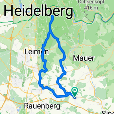
Trailrunde am Königstuhl
A cycling route starting in Horrenberg, Baden-Wurttemberg, Germany.
Overview
About this route
Access via bike paths and gravel roads to the forest cabin; from there, a nice trail leads almost to Bierhelderhof. From there, it's an easy gradient up to almost Gaiberger-Str. Just before reaching it, turn sharply left onto the small trail. Cross the road and continue on the trail until Drei Eichen. The way home leads via Wieslocher Weg over a small trail to Lingental. From there, a piece of road (about 1 km) back to home via the quarry.
- -:--
- Duration
- 38.6 km
- Distance
- 741 m
- Ascent
- 714 m
- Descent
- ---
- Avg. speed
- 471 m
- Max. altitude
Route quality
Waytypes & surfaces along the route
Waytypes
Track
24.7 km
(64 %)
Path
8.1 km
(21 %)
Surfaces
Paved
18.5 km
(48 %)
Unpaved
17.8 km
(46 %)
Asphalt
15.8 km
(41 %)
Gravel
10.4 km
(27 %)
Continue with Bikemap
Use, edit, or download this cycling route
You would like to ride Trailrunde am Königstuhl or customize it for your own trip? Here is what you can do with this Bikemap route:
Free features
- Save this route as favorite or in collections
- Copy & plan your own version of this route
- Sync your route with Garmin or Wahoo
Premium features
Free trial for 3 days, or one-time payment. More about Bikemap Premium.
- Navigate this route on iOS & Android
- Export a GPX / KML file of this route
- Create your custom printout (try it for free)
- Download this route for offline navigation
Discover more Premium features.
Get Bikemap PremiumFrom our community
Other popular routes starting in Horrenberg
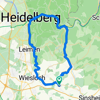
 HBG-Königstuhl-HBG
- Distance
- 42.2 km
- Ascent
- 836 m
- Descent
- 836 m
- Location
- Horrenberg, Baden-Wurttemberg, Germany
 Königstuhl 4 auf bikemap
- Distance
- 18.1 km
- Ascent
- 475 m
- Descent
- 81 m
- Location
- Horrenberg, Baden-Wurttemberg, Germany
 Heute nachmittag
- Distance
- 34.8 km
- Ascent
- 301 m
- Descent
- 338 m
- Location
- Horrenberg, Baden-Wurttemberg, Germany
 Horrenberg_HD_NG_Gaiberg_Nussloch_Loop
- Distance
- 53.3 km
- Ascent
- 316 m
- Descent
- 367 m
- Location
- Horrenberg, Baden-Wurttemberg, Germany
 Abschlussfahrt 2013 -1
- Distance
- 130.6 km
- Ascent
- 995 m
- Descent
- 806 m
- Location
- Horrenberg, Baden-Wurttemberg, Germany
 Horrenberg - Nürnberg
- Distance
- 210.5 km
- Ascent
- 967 m
- Descent
- 824 m
- Location
- Horrenberg, Baden-Wurttemberg, Germany
 Kolpingstraße nach Kolpingstraße
- Distance
- 59.3 km
- Ascent
- 564 m
- Descent
- 612 m
- Location
- Horrenberg, Baden-Wurttemberg, Germany
 Dielheim-kraichgau
- Distance
- 97.7 km
- Ascent
- 969 m
- Descent
- 877 m
- Location
- Horrenberg, Baden-Wurttemberg, Germany
Open it in the app